F2.7 Ephemeral salt lakes
F2. Lakes biome
F2
Profile summary
Full profile at https://global-ecosystems.org/explore/groups/F2.7
Brief description
Ephemeral salt lakes in semi-arid and arid regions are shallow, with extreme variation in salinity during wet-dry cycles that limits life to a low diversity of specialised salt-tolerant species. The lakes are dry and salt-encrusted most of the time, but episodic inundation dilutes salt, allowing high growth of algae and larger plants which support crustaceans, insect larvae, fish and specialist waterbirds. These species use dormant life stages to survive drying, or disperse rapidly to other habitats when the lake dries.
Key features
Salt lakes with salt crusts in long dry phases and short productive wet phases. Trophic networks are simple but high productivity is driven by bacteria and phytoplankton, supporting specialist birds.
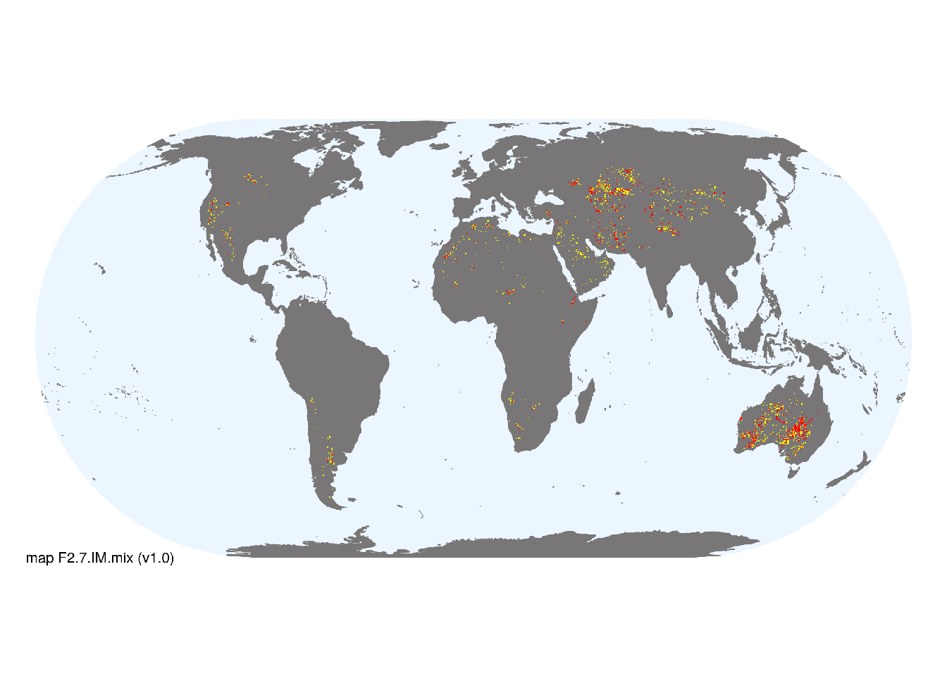
Overview of distribution
Mostly in arid and semi-arid Africa, Eurasia, Australia and North and South America.
Map description
Location of ephemeral lakes was taken from global lake databases (Lehner and Döll 2004; types 1 and 3 from Messager et al. 2016), intersected with estimates of ephemeral surface water (classes 9 and 10 from Pekel et al. 2016) and the distribution of arid and semi-arid, endorheic basins (Linke et al. 2019). Occurrences were aggregated to 10 minutes spatial resolution. Occurrences were aggregated to 10 minutes spatial resolution..
Map code and version: F2.7.web.mix v1.0, available at ![]()
Version history
Profile versions
- v2.1 (2022-04-06): RT Kingsford; JT Hollibaugh; K Irvine; R Harper; DA Keith.1
- v2.01 (2021-12-31): NA.
- v2.0 (2020-06-18): RT Kingsford; JT Hollibaugh; K Irvine; R Harper; DA Keith.
- v1.0 (2020-01-20): RT Kingsford; DA Keith.
- v1.0 (2020-05-20): RT Kingsford; DA Keith.
Available maps
Read more details about the current map versions here.
- Indicative Map (code: F2.7.IM.mix, version v1.0)
- Web navigation (code: F2.7.web.mix, version v1.0)

Read more details about older or alternative versions of maps for this functional group.
- Indicative Map: discarded (code: F2.7.IM.alt, version v2.0)
- Indicative Map: discarded (code: F2.7.IM.orig, version v1.0)
- Web navigation: duplicated (code: F2.7.web.map, version v1.0)
- Web navigation: requires review (code: F2.7.web.orig, version v1.0)
References
Main references
References used in the different versions of the profiles.
- McCulloch G., Aebischer A,Irvine, K (2003) Satellite tracking of flamingos in southern Africa: the importance of small wetlands for management and conservation Oryx 37, 480–483
- Seaman MT, Ashton PJ, Williams WD (1991) Inland salt waters of southern Africa Hydrobiologia 210: 75-91
- Williams WD (1998) Salinity as a determinant of the structure of biological communities in salt lakes Hydrobiologia 381:191-201
Map references
References used in the different versions of the maps (current and discarded).
- Abell R, Thieme ML, Revenga C, Bryer M, Kottelat M, Bogutskaya N, Coad B, Mandrak N, Contreras Balderas S, Bussing W, Stiassny MLJ, Skelton P, Allen GR, Unmack P, Naseka A, Ng R, Sindorf N, Robertson J, Armijo E, Higgins JV, Heibel TJ, Wikramanayake E, Olson D, López HL, Reis RE, Lundberg JG, Sabaj Pérez MH, Petry P (2008) Freshwater ecoregions of the world: A new map of biogeographic units for freshwater biodiversity conservation, BioScience 58: 403–414. DOI:10.1641/B580507
- Harris, I., Jones, P.D., Osborn, T.J. and Lister, D.H. (2014), Updated high-resolution grids of monthly climatic observations - the CRU TS3.10 Dataset. International Journal of Climatology 34, 623-642 doi:10.1002/joc.3711 Revised appendix
- Lehner, B. and Döll, P. (2004): Development and validation of a global database of lakes, reservoirs and wetlands. Journal of Hydrology 296/1-4: 1-22. Data-set
- Linke, S., Lehner, B., Ouellet Dallaire, C., Ariwi, J., Grill, G., Anand, M., Beames, P., Burchard-Levine, V., Maxwell, S., Moidu, H., Tan, F., Thieme, M. (2019) Global hydro-environmental sub-basin and river reach characteristics at high spatial resolution Scientific Data 6: 283 DOI:10.1038/s41597-019-0300-6
- Messager, M.L., Lehner, B., Grill, G., Nedeva, I., Schmitt, O. (2016) Estimating the volume and age of water stored in global lakes using a geo-statistical approach Nature Communications 13603 DOI:10.1038/ncomms13603
- Pekel JF, Cottam A, Gorelick N, Belward AS (2016) High-resolution mapping of global surface water and its long-term changes Nature 540, 418-422 DOI:10.1038/nature20584
Footnotes
This is the current version available at official site.↩︎