TF1.5 Episodic arid floodplains
TF1. Palustrine wetlands biome
TF1
Profile summary
Full profile at https://global-ecosystems.org/explore/groups/TF1.5
Brief description
Episodic arid floodplains rarely flood and are predominantly dry, sometimes for years. They are supplied by temporary rivers in semi-arid and arid regions of all continents. When floods come, there is a spike in productivity as nutrients mobilise from leaf litter and organic matter. At such times, dormant plants and animals form complex food webs, capitalising on short periods of high productivity.
Key features
Highly productive floodplains when flooded, supporting highly diverse and complex trophic networks, followed by long periods of low productivity when dry.
Overview of distribution
Semi-ard and arid regions.
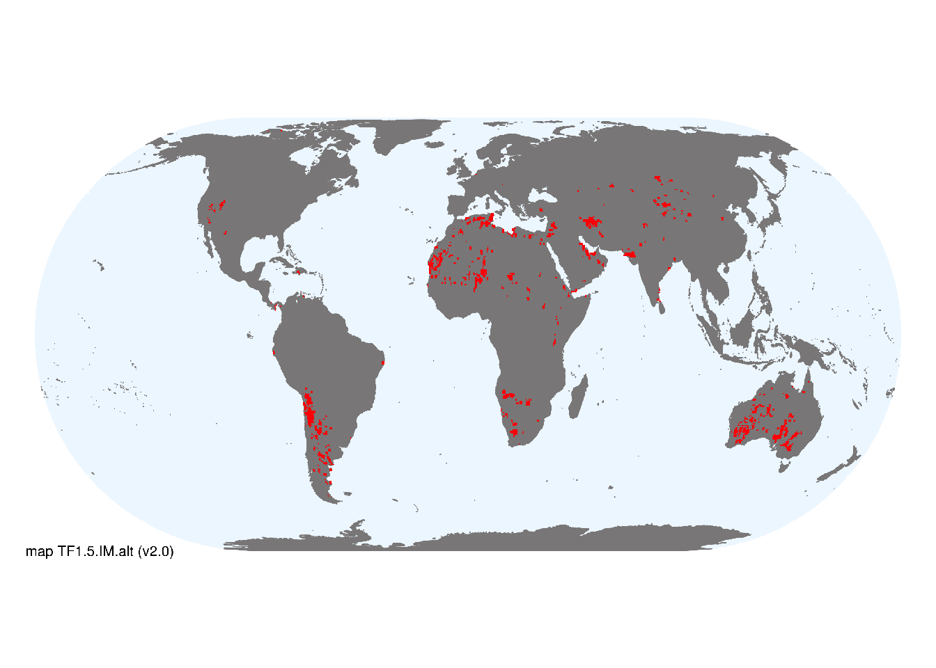
Map description
Locations of pan, brackish and saline wetlands were taken from the Global Lakes and Wetlands Database GLWD3 class 7 from Lehner and Döll (2004). .
Map code and version: TF1.5.web.map v2.0, available at ![]()
Version history
Profile versions
- v2.1 (2022-04-06): RT Kingsford; R Mac Nally; AH Arthington; JA Catford; B Robson; DA Keith.1
- v2.01 (2021-12-31): NA.
- v2.0 (2020-05-31): RT Kingsford; R Mac Nally; AH Arthington; JA Catford; B Robson; DA Keith.
- v1.0 (2020-01-20): RT Kingsford; RC Mac Nally; DA Keith.
Available maps
Read more details about the current map versions here.
- Web navigation (code: TF1.5.web.map, version v2.0)

- Web navigation (code: TF1.5.WM.nwx, version v1.0)
Read more details about older or alternative versions of maps for this functional group.
- Web navigation: requires review (code: TF1.5.web.alt, version v2.0)
- Indicative Map: superceeded (code: TF1.5.IM.alt, version v2.0)
- Indicative Map: discarded (code: TF1.5.IM.orig, version v1.0)
- Web navigation: discarded (code: TF1.5.web.map, version v1.0)
- Web navigation: requires review (code: TF1.5.web.orig, version v1.0)
References
Main references
References used in the different versions of the profiles.
- Arthington AH, Balcombe S (2011) Extreme flow variability and the ‘boom and bust’ ecology of fish in arid-zone floodplain rivers: a case history with implications for environmental flows, conservation and management Ecohydrology 4, 706-720
- Bunn SE, Balcombe SR, Davies PM, Fellows CS, McKenzie-Smith FJ (2006) Aquatic productivity and food webs of desert river ecosystems Ecology of desert rivers (Ed. RT Kingsford), pp76-99. Cambridge University Press, Cambridge
- McInerney PJ, Rick J. Stoffels RJ, Shackleton ME, Davey CD (2017) Flooding drives a macroinvertebrate biomass boom in ephemeral floodplain wetlands Freshwater Science 36: 726-738
Map references
References used in the different versions of the maps (current and discarded).
- Abell R, Thieme ML, Revenga C, Bryer M, Kottelat M, Bogutskaya N, Coad B, Mandrak N, Contreras Balderas S, Bussing W, Stiassny MLJ, Skelton P, Allen GR, Unmack P, Naseka A, Ng R, Sindorf N, Robertson J, Armijo E, Higgins JV, Heibel TJ, Wikramanayake E, Olson D, López HL, Reis RE, Lundberg JG, Sabaj Pérez MH, Petry P (2008) Freshwater ecoregions of the world: A new map of biogeographic units for freshwater biodiversity conservation, BioScience 58: 403–414. DOI:10.1641/B580507
- Lehner, B. and Döll, P. (2004): Development and validation of a global database of lakes, reservoirs and wetlands. Journal of Hydrology 296/1-4: 1-22. Data-set
- Pekel JF, Cottam A, Gorelick N, Belward AS (2016) High-resolution mapping of global surface water and its long-term changes Nature 540, 418-422 DOI:10.1038/nature20584
Footnotes
This is the current version available at official site.↩︎