TF1.3 Permanent marshes
TF1. Palustrine wetlands biome
TF1
Profile summary
Full profile at https://global-ecosystems.org/explore/groups/TF1.3
Brief description
Permanent marshes occur throughout tropical and temperate regions of the world in flat areas with stable water levels close to the surface. They are essentially treeless, with extensive reedbeds and aquatic grasses, interspersed with patches of open water. Food webs are strongly influenced by highly productive algae and plants, providing food for large numbers of invertebrates, waterbirds, reptiles, and mammals.
Key features
Shallow permanently inundated freshwater wetlands, dominated by herbaceous macrophytes, supporting high primary productivity and complex trophic networks with abundant insects, birds and amphibians.
Overview of distribution
Mainly on floodplains in catchments with humid tropical or temperate climates.
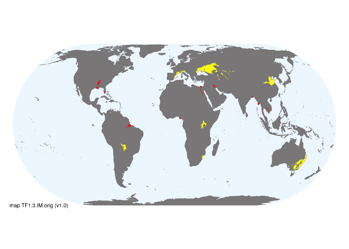
Map description
Terrestrial ecoregions containing major or minor occurrences of this ecosystem functional group were identified by consulting available ecoregion descriptions (Dinerstein et al. 2017), global and regional reviews, national and regional ecosystem maps, locations of relevant examples, and proofed by expert reviewers. Consequently they are coarse-scale indicative representations of distribution, except where they occupy small ecoregions. Ecoregions were mapped at 30 arc second spatial resolution..
Map code and version: TF1.3.web.orig v1.0, available at ![]()
Version history
Profile versions
- v2.1 (2022-04-06): RT Kingsford; JA Catford; MC Rains; B Robson; DA Keith.1
- v2.01 (2021-12-31): NA.
- v2.0 (2020-05-31): RT Kingsford; JA Catford; MC Rains; B Robson; DA Keith.
- v1.0 (2020-01-20): RT Kingsford; DA Keith.
Available maps
Read more details about the current map versions here.
- Indicative Map (code: TF1.3.IM.orig, version v1.0)
- Web navigation (code: TF1.3.web.orig, version v1.0)

Read more details about older or alternative versions of maps for this functional group.
- Web navigation: in preparation (code: TF1.3.WM.nwx, version v1.0)
References
Main references
References used in the different versions of the profiles.
- Grace JB, Wetzel RG (1981) Habitat partitioning and competitive displacement in cattails (Typha): experimental field studies The American Naturalist 118:463-474 DOI:10.1086/283841
Map references
References used in the different versions of the maps (current and discarded).
- Dinerstein E, Olson D, Joshi A, Vynne C, Burgess ND, Wikramanayake E, Hahn N, Palminteri S, Hedao P, Noss R, Hansen M, Locke H, Ellis EE, Jones B, Barber CV, Hayes R, Kormos C, Martin V, Crist E, Sechrest W, Price L, Baillie JEM, Weeden D, Suckling K, Davis C, Sizer N, Moore R, Thau D, Birch T, Potapov P, Turubanova S, Tyukavina A, de Souza N, Pintea L, Brito JC, Llewellyn Barnekow Lillesø JP, van Breugel P, Graudal L, Voge M, Al-Shammari KF, Saleem M (2017) An Ecoregion-Based Approach to Protecting Half the Terrestrial Realm, BioScience 67: 534–545. DOI:10.1093/biosci/bix014. Data-set available on-line
- Thomas Gumbricht Rosa Maria Roman‐Cuesta Louis Verchot Martin Herold Florian Wittmann Ethan Householder Nadine Herold Daniel Murdiyarso (2017) An expert system model for mapping tropical wetlands and peatlands reveals South America as the largest contributor Glob Change Biol. 23: 3581– 3599 DOI:10.1111/gcb.13689
Footnotes
This is the current version available at official site.↩︎