TF1.2 Subtropical/temperate forested wetlands
TF1. Palustrine wetlands biome
TF1
Profile summary
Full profile at https://global-ecosystems.org/explore/groups/TF1.2
Brief description
Forested wetlands in temperate and subtropical climates undergo periodic flooding. One or two tree species dominate the canopy. Trees shape the flow of flood waters, the ground surface, and the understorey, as well as animal habitats. With flooding, complex aquatic food webs support turtles, frogs, fish and birds, but can produce microbial blooms with nutrients flushed from the floodplain. Many vertebrates use these wetlands as refuges during dry times.
Key features
Permently to seasonally wet (or flooded), nutrient poor, to nutrient rich, open to closed canopy forests, often on organic soils (peat); poor in woody species, high abundance of mosses and sedges and no to open woody species cover.
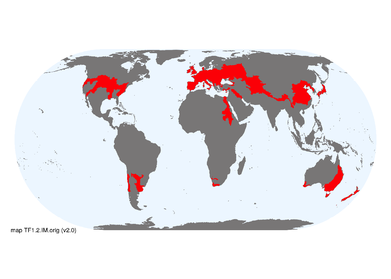
Overview of distribution
Subtropical to temperate regions of both hemispheres, mostly in humid climates.
Map description
Terrestrial ecoregions containing major or minor occurrences of this ecosystem functional group were identified by consulting available ecoregion descriptions (Dinerstein et al. 2017), global and regional reviews, national and regional ecosystem maps, locations of relevant examples, and proofed by expert reviewers. Consequently they are coarse-scale indicative representations of distribution, except where they occupy small ecoregions. Ecoregions were mapped at 30 arc second spatial resolution..
Map code and version: TF1.2.web.orig v2.0, available at ![]()
Version history
Profile versions
- v2.1 (2022-04-06): R Mac Nally; RT Kingsford; JA Catford; B Robson; DA Keith.1
- v2.01 (2021-12-31): NA.
- v2.0 (2020-06-17): R Mac Nally; RT Kingsford; JA Catford; B Robson; DA Keith.
- v1.0 (2020-01-20): RC Mac Nally; RT Kingsford; DA Keith.
Available maps
Read more details about the current map versions here.
- Web navigation (code: TF1.2.web.orig, version v2.0)

- Indicative Map (code: TF1.2.IM.orig, version v2.0)
Read more details about older or alternative versions of maps for this functional group.
- Indicative Map: discarded (code: TF1.2.IM.alt, version v2.0)
- Indicative Map: discarded (code: TF1.2.IM.orig, version v1.0)
- Web navigation: in preparation (code: TF1.2.WM.nwx, version v1.0)
- Web navigation: requires review (code: TF1.2.web.orig, version v1.0)
References
Main references
References used in the different versions of the profiles.
- Mac Nally R, Cunningham SC, Baker PJ, Horner GJ, Thomson JR (2011) Dynamics of Murray-Darling floodplain forests under multiple stressors: The past, present, and future of an Australian icon Water Resources Research 47, W00g05
Map references
References used in the different versions of the maps (current and discarded).
- Beck, H., Zimmermann, N., McVicar, T. et al. (2018) Present and future Köppen-Geiger climate classification maps at 1-km resolution Sci Data 5, 180214 DOI:10.1038/sdata.2018.214
- Dinerstein E, Olson D, Joshi A, Vynne C, Burgess ND, Wikramanayake E, Hahn N, Palminteri S, Hedao P, Noss R, Hansen M, Locke H, Ellis EE, Jones B, Barber CV, Hayes R, Kormos C, Martin V, Crist E, Sechrest W, Price L, Baillie JEM, Weeden D, Suckling K, Davis C, Sizer N, Moore R, Thau D, Birch T, Potapov P, Turubanova S, Tyukavina A, de Souza N, Pintea L, Brito JC, Llewellyn Barnekow Lillesø JP, van Breugel P, Graudal L, Voge M, Al-Shammari KF, Saleem M (2017) An Ecoregion-Based Approach to Protecting Half the Terrestrial Realm, BioScience 67: 534–545. DOI:10.1093/biosci/bix014. Data-set available on-line
- Thomas Gumbricht Rosa Maria Roman‐Cuesta Louis Verchot Martin Herold Florian Wittmann Ethan Householder Nadine Herold Daniel Murdiyarso (2017) An expert system model for mapping tropical wetlands and peatlands reveals South America as the largest contributor Glob Change Biol. 23: 3581– 3599 DOI:10.1111/gcb.13689
- Lehner, B. and Döll, P. (2004): Development and validation of a global database of lakes, reservoirs and wetlands. Journal of Hydrology 296/1-4: 1-22. Data-set
- Tuanmu, M.-N. and W. Jetz (2014) A global 1-km consensus land-cover product for biodiversity and ecosystem modeling Global Ecology and Biogeography 23(9):1031–1045 DOI:10.1111/geb.12182
Footnotes
This is the current version available at official site.↩︎