T7.4 Urban and industrial ecosystems
T7. Intensive land-use biome
T7
Profile summary
Full profile at https://global-ecosystems.org/explore/groups/T7.4
Brief description
Cities, smaller settlements and industrial areas are structurally complex ecosystems and characterised by their highly dynamic spatial structure. Diverse patch types include buildings, paved surfaces, transport infrastructure, parks and gardens; excavations, bare ground and refuse areas. Patches undergo periodic destruction and renewal. Human population density is high, relative to other ecosystems, and dependent on large subsidies of imported resources (particularly water, nutrients and food). Interactions among patch types and human social behaviours produce emergent properties and complex feedbacks among ecosystem components.
Key features
Ecosystems dominated by anthroipogenic structures (e.g. buildings, roads, wastelands) associated with human infrastructures, intensive anthropogenic disturbance regimes, and severely altered biogeochemical site conditions.
Overview of distribution
Abundant worldwide in all regions settled by humans.
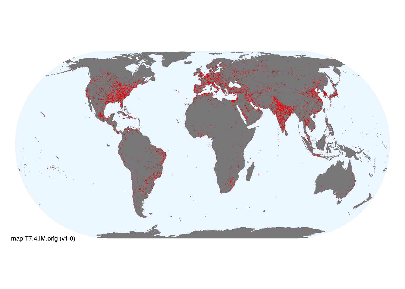
Map description
The indicative distribution of Urban and infrastructure lands was estimated using spatial data for night light brightness (values >0 in NCEI 2019; Cinzano, et al. 2019).
Map code and version: T7.4.web.orig v1.0, available at ![]()
Version history
Profile versions
- v2.1 (2022-04-06): DA Keith; RT Corlett.1
- v2.01 (2021-12-31): NA.
- v2.0 (2020-05-31): DA Keith; RT Corlett.
- v1.0 (2020-01-20): .
Available maps
Read more details about the current map versions here.
- Indicative Map (code: T7.4.WM.nwx, version v1.0)
Read more details about older or alternative versions of maps for this functional group.
- Indicative Map: requires review (code: T7.4.IM.orig, version v1.0)
- Web navigation: discarded (code: T7.4.web.orig, version v1.0)

References
Main references
References used in the different versions of the profiles.
- Alberti M, Marzluff JM, Shulenberger E, Bradley G, Ryan C, Zumbrunnen C (2003) Integrating Humans into Ecology: Opportunities and Challenges for Studying Urban Ecosystems Urban Ecology (Eds. Marzluff J.M. et al.) Springer, Boston, MA DOI:10.1007/978-0-387-73412-5_9
- Grimm NB, Faeth SH, Golubiewski NE, Redman CL, Wu J, Bai X, Briggs JM (2008) Global change and the ecology of cities Science 319: 756-760
Map references
References used in the different versions of the maps (current and discarded).
- Cinzano P, Falchi F, C. D. Elvidge CD (2019) The world atlas of the artificial night sky brightness Copyright Royal Astronomical Society. Reproduced from the Monthly Notices of the RAS by permission of Blackwell Science. University of Padova & NOAA National Geophysical Data Center, Boulder. Webpage
- Karra, Kontgis, et al. (2021) Global land use/land cover with Sentinel-2 and deep learning IGARSS 2021-2021 IEEE International Geoscience and Remote Sensing Symposium IEEE
- VIIRS Day/Night Band Nighttime Lights, Version 1; Earth Observation Group, NOAA National Centers for Environmental Information (NCEI). Data-set
Footnotes
This is the current version available at official site.↩︎