T6.5 Tropical alpine grasslands and herbfields
T6. Polar/alpine (cryogenic) biome
T6
Profile summary
Full profile at https://global-ecosystems.org/explore/groups/T6.5
Brief description
Tropical alpine grasslands and herbfields are limited to a few mountainous areas of Africa, the Americas and southeast Asia. Productivity is low, limited by dry conditions, rocky substrate and nightly cold, but is not strongly seasonal. Snow and fog are common. Typical flora includes mosses, lichens, and flowering plants including distinctive megaherbs and low shrubs. Plant species have adaptations for cold dry conditions, such as tiny leaves, cushion and rosette growth forms and slow growth. Plant composition is affected by competition and facilitation between species, as well as grazing and occasional fires. Simple foodwebs include invertebrates, small mammals and reptiles, along with visiting predators and occasional herbivores from lowland savannas.
Key features
Dense perennial C3 cold tolerant tussock grasslands, with distinctive arborescent rosette and cushion growth forms, treeless except for sheltered gullies..
Overview of distribution
High mountain tops of tropics.
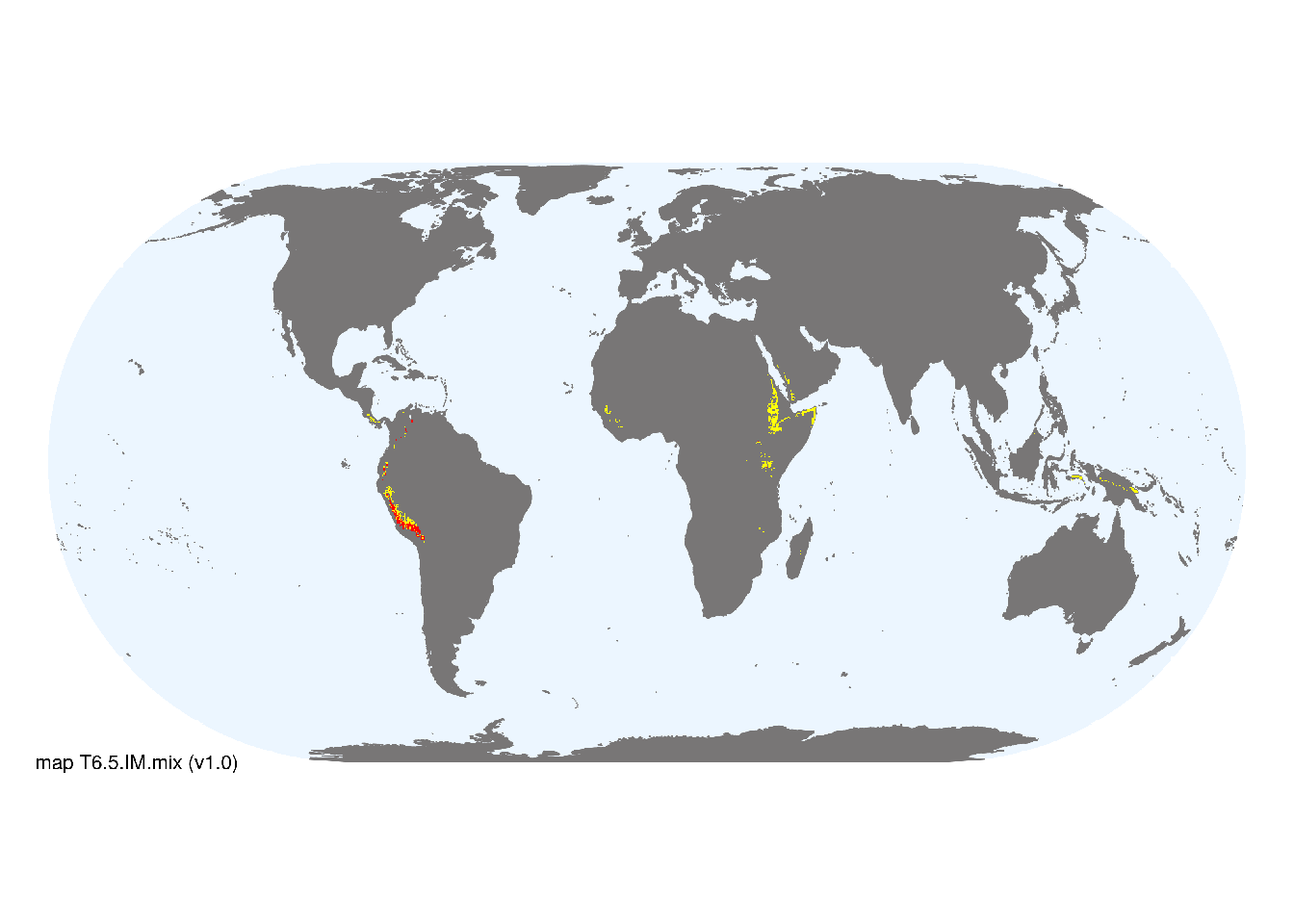
Map description
Major and minor occurrences were initially identified using consensus land-cover maps (Tuanmu et al. 2014) and then cropped to selected terrestrial ecoregions (Dinerstein et al. 2017) at 30 arc seconds spatial resolution. Ecoregions were selected if: i) their descriptions mentioned features consistent with those identified in the profile of the Ecosystem Functional Group; and ii) if their location was consistent with the ecological drivers described in the profile..
Map code and version: T6.5.web.mix v1.0, available at ![]()
Version history
Profile versions
- v2.1 (2022-04-06): DA Keith; A Etter.1
- v2.01 (2021-12-31): NA.
- v2.0 (2020-05-31): DA Keith; A Etter.
- v1.0 (2020-01-20): DA Keith; A Etter.
Available maps
Read more details about the current map versions here.
- Web navigation (code: T6.5.web.mix, version v1.0)

- Indicative Map (code: T6.5.IM.mix, version v1.0)
Read more details about older or alternative versions of maps for this functional group.
- Indicative Map: discarded (code: T6.5.IM.alt, version v2.1)
- Web navigation: requires review (code: T6.5.web.orig, version v1.0)
- Indicative Map: discarded (code: T6.5.IM.orig, version v1.0)
- Web navigation: in preparation (code: T6.5.WM.nwx, version v1.0)
References
Main references
References used in the different versions of the profiles.
- Smith AP, Young TP (1987) Tropical alpine plant ecology Annual Review of Ecology and Systematics 18: 137-58 DOI:10.1017/cbo9780511551475.021
Map references
References used in the different versions of the maps (current and discarded).
- Dinerstein E, Olson D, Joshi A, Vynne C, Burgess ND, Wikramanayake E, Hahn N, Palminteri S, Hedao P, Noss R, Hansen M, Locke H, Ellis EE, Jones B, Barber CV, Hayes R, Kormos C, Martin V, Crist E, Sechrest W, Price L, Baillie JEM, Weeden D, Suckling K, Davis C, Sizer N, Moore R, Thau D, Birch T, Potapov P, Turubanova S, Tyukavina A, de Souza N, Pintea L, Brito JC, Llewellyn Barnekow Lillesø JP, van Breugel P, Graudal L, Voge M, Al-Shammari KF, Saleem M (2017) An Ecoregion-Based Approach to Protecting Half the Terrestrial Realm, BioScience 67: 534–545. DOI:10.1093/biosci/bix014. Data-set available on-line
- Martin Jung, Prabhat Raj Dahal, Stuart H. M. Butchart, Paul F. Donald, Xavier De Lamo, Myroslava Lesiv, … Piero Visconti. (2020). A global map of terrestrial habitat types [Data set]. Zenodo. DOI: 10.5281/zenodo.3673586
- Testolin, R., Attorre, F. and Jiménez‐Alfaro, B. (2020) Global distribution and bioclimatic characterization of alpine biomes Ecography 43: 779-788 DOI:10.1111/ecog.05012
- Tuanmu, M.-N. and W. Jetz (2014) A global 1-km consensus land-cover product for biodiversity and ecosystem modeling Global Ecology and Biogeography 23(9):1031–1045 DOI:10.1111/geb.12182
Footnotes
This is the current version available at official site.↩︎