T5.2 Succulent or Thorny deserts and semi-deserts
T5. Deserts and semi-deserts biome
T5
Profile summary
Full profile at https://global-ecosystems.org/explore/groups/T5.2
Brief description
Succulent or Thorny deserts and semi-deserts are restricted in their occurrence to parts of the Americas, Africa, Madagascar and south Asia. They have a sparse cover of typical cactus-like plants and other slow-growing spiny and succulent species, on stony low-nutrient soils. Many of these plants store water in their stems and have deep roots. Short-lived plant species emerge after rains from dormant organs or soil seed banks. Plants and animals tolerate extreme summer temperatures and mild winters. Nocturnal and burrowing mammals are able to avoid extreme temperatures. Diverse opportunistic invertebrates and reptiles occur, along with small numbers of large-ranging ungulates.
Key features
Characterized by tall succulent plants, diverse annuals and geophytes, supporting diverse mammals, reptiles and invertebrates.
Overview of distribution
Subtropical latitudes of the Americas, southern Africa and southern Asia.
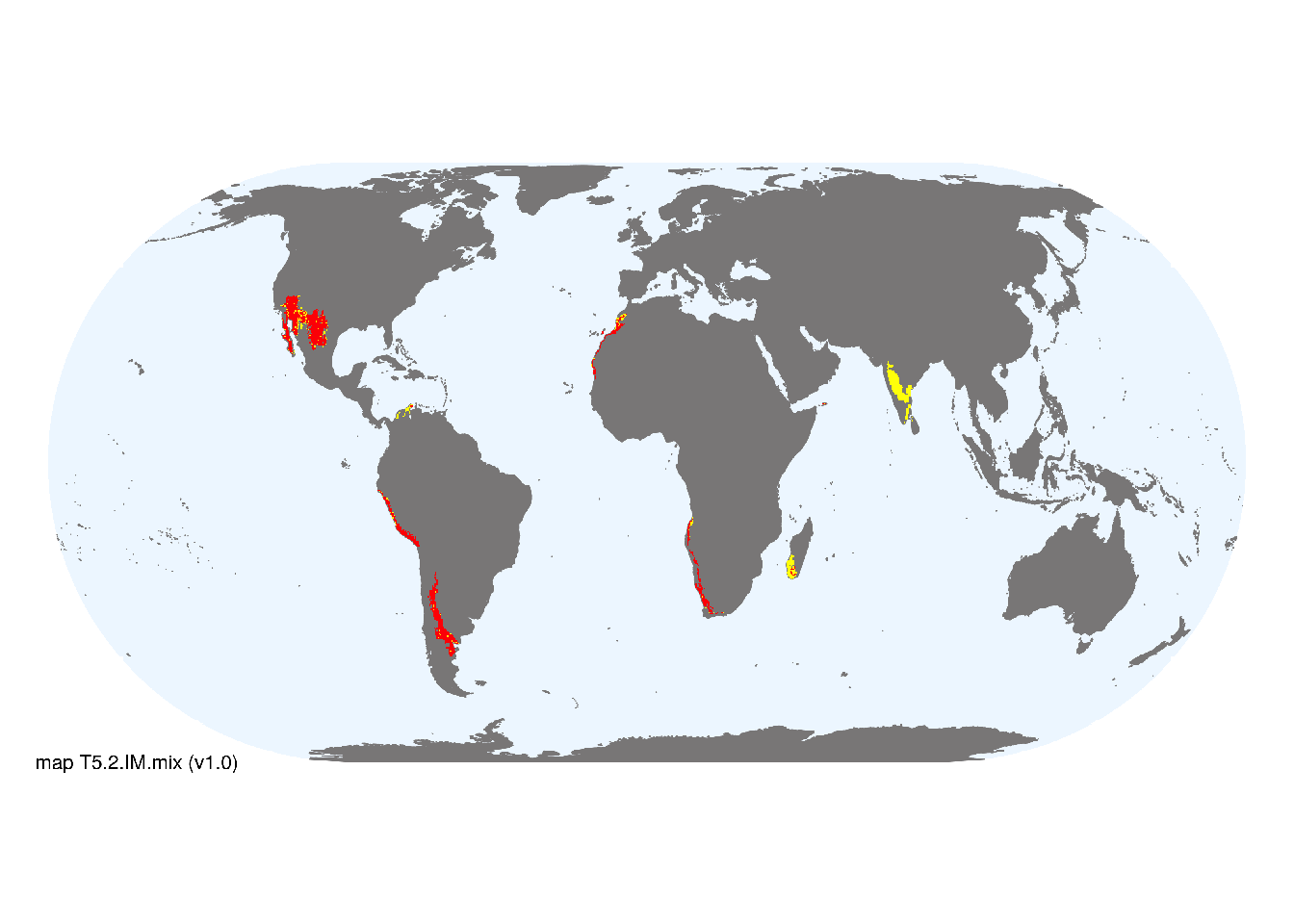
Map description
Major and minor occurrences were initially identified using consensus land-cover maps (Tuanmu et al. 2014) and then cropped to selected terrestrial ecoregions (Dinerstein et al. 2017) at 30 arc seconds spatial resolution. Ecoregions were selected if: i) their descriptions mentioned features consistent with those identified in the profile of the Ecosystem Functional Group; and ii) if their location was consistent with the ecological drivers described in the profile..
Map code and version: T5.2.web.mix v1.0, available at ![]()
Version history
Profile versions
- v2.1 (2022-04-06): MG Tozer; DA Keith.1
- v2.01 (2021-12-31): NA.
- v2.0 (2020-05-31): MG Tozer; DA Keith.
- v1.0 (2020-01-20): MG Tozer; DA Keith.
Available maps
Read more details about the current map versions here.
- Web navigation (code: T5.2.web.mix, version v1.0)

- Indicative Map (code: T5.2.IM.mix, version v1.0)
Read more details about older or alternative versions of maps for this functional group.
- Indicative Map: discarded (code: T5.2.IM.alt, version v2.0)
- Indicative Map: discarded (code: T5.2.IM.orig, version v1.0)
- Web navigation: requires review (code: T5.2.web.orig, version v1.0)
References
Main references
References used in the different versions of the profiles.
- Shmida A, Evenari M, Noy-Meir I (1986) Hot desert ecosystems: an integrated view Ecosystems of the World, Vol. 12b: Hot deserts and arid shrublands (Eds. M Evenari, I Noy Meir, DW Goodall), pp. 379-387. . Elsevier, Amsterdam
Map references
References used in the different versions of the maps (current and discarded).
- Beck, H., Zimmermann, N., McVicar, T. et al. (2018) Present and future Köppen-Geiger climate classification maps at 1-km resolution Sci Data 5, 180214 DOI:10.1038/sdata.2018.214
- Dinerstein E, Olson D, Joshi A, Vynne C, Burgess ND, Wikramanayake E, Hahn N, Palminteri S, Hedao P, Noss R, Hansen M, Locke H, Ellis EE, Jones B, Barber CV, Hayes R, Kormos C, Martin V, Crist E, Sechrest W, Price L, Baillie JEM, Weeden D, Suckling K, Davis C, Sizer N, Moore R, Thau D, Birch T, Potapov P, Turubanova S, Tyukavina A, de Souza N, Pintea L, Brito JC, Llewellyn Barnekow Lillesø JP, van Breugel P, Graudal L, Voge M, Al-Shammari KF, Saleem M (2017) An Ecoregion-Based Approach to Protecting Half the Terrestrial Realm, BioScience 67: 534–545. DOI:10.1093/biosci/bix014. Data-set available on-line
- Tuanmu, M.-N. and W. Jetz (2014) A global 1-km consensus land-cover product for biodiversity and ecosystem modeling Global Ecology and Biogeography 23(9):1031–1045 DOI:10.1111/geb.12182
Footnotes
This is the current version available at official site.↩︎