T3.1 Seasonally dry tropical shrublands
T3. Shrublands and shrubby woodlands biome
T3
Profile summary
Full profile at https://global-ecosystems.org/explore/groups/T3.1
Brief description
Occurring on nutrient-deficient soils of tropical regions, these fire-prone shrublands and low forests are associated with dry tropical winters, often occurring in a matrix with savannas (T4.2) or tropical dry forests (T1.2). Dominated by small-leaved sclerophyll shrubs and grasses, plants have traits to capture and conserve nutrients, such as cluster roots and carnivorous forms. Birds, reptiles and seed-eating small mammals dominate the vertebrate fauna, with few vertebrate herbivores. Periodic fires are cues for life-history processes of plants and animals, and help maintain species composition and nutrient cycling.
Key features
Mostly evergreen, sclerophyll shrublands on nutrient-poor soils, C4 grasses can be important.
Overview of distribution
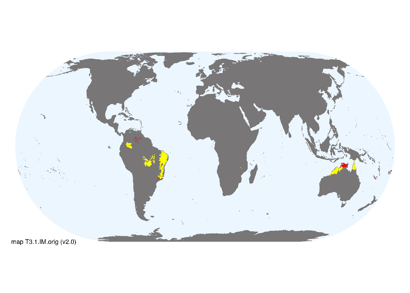
Global seasonally-dry tropics : South America, Australia, oceanic high islands.
Map description
Terrestrial ecoregions containing major or minor occurrences of this ecosystem functional group were identified by consulting available ecoregion descriptions (Dinerstein et al. 2017), global and regional reviews, national and regional ecosystem maps, locations of relevant examples, and proofed by expert reviewers. Consequently they are coarse-scale indicative representations of distribution, except where they occupy small ecoregions. Ecoregions were mapped at 30 arc second spatial resolution..
Map code and version: T3.1.web.orig v2.0, available at ![]()
Version history
Profile versions
- v2.1 (2022-04-06): DA Keith; J Russell-Smith.1
- v2.01 (2021-12-31): NA.
- v2.0 (2020-05-31): DA Keith; J Russell-Smith.
- v1.0 (2020-01-20): DA Keith.
Available maps
Read more details about the current map versions here.
- Web navigation (code: T3.1.web.orig, version v2.0)

- Indicative Map (code: T3.1.IM.orig, version v2.0)
Read more details about older or alternative versions of maps for this functional group.
- Indicative Map: discarded (code: T3.1.IM.alt, version v2.1)
- Indicative Map: discarded (code: T3.1.IM.mix, version v1.0)
- Indicative Map: discarded (code: T3.1.IM.orig, version v1.0)
- Web navigation: requires review (code: T3.1.web.orig, version v1.0)
References
Main references
References used in the different versions of the profiles.
- Fernandes GW (2016) Ecology and conservation of mountaintop grasslands in Brazil Springer: Berlin
- Morellato LPC, Silveira.FAO (2018) Plant life in campo rupestre: New lessons from an ancient biodiversity hotspot Flora 238: 1-10
- Russell-Smith J, Ryan PG, Klessa D, Waight G, Harwood R (1998) Fire regimes, fire-sensitive vegetation, and fire management of the sandstone Arnhem Plateau, monsoonal northern Australia Journal of Applied Ecology 35, 829-846
Map references
References used in the different versions of the maps (current and discarded).
- Dinerstein E, Olson D, Joshi A, Vynne C, Burgess ND, Wikramanayake E, Hahn N, Palminteri S, Hedao P, Noss R, Hansen M, Locke H, Ellis EE, Jones B, Barber CV, Hayes R, Kormos C, Martin V, Crist E, Sechrest W, Price L, Baillie JEM, Weeden D, Suckling K, Davis C, Sizer N, Moore R, Thau D, Birch T, Potapov P, Turubanova S, Tyukavina A, de Souza N, Pintea L, Brito JC, Llewellyn Barnekow Lillesø JP, van Breugel P, Graudal L, Voge M, Al-Shammari KF, Saleem M (2017) An Ecoregion-Based Approach to Protecting Half the Terrestrial Realm, BioScience 67: 534–545. DOI:10.1093/biosci/bix014. Data-set available on-line
- Martin Jung, Prabhat Raj Dahal, Stuart H. M. Butchart, Paul F. Donald, Xavier De Lamo, Myroslava Lesiv, … Piero Visconti. (2020). A global map of terrestrial habitat types [Data set]. Zenodo. DOI: 10.5281/zenodo.3673586
- Tuanmu, M.-N. and W. Jetz (2014) A global 1-km consensus land-cover product for biodiversity and ecosystem modeling Global Ecology and Biogeography 23(9):1031–1045 DOI:10.1111/geb.12182
Footnotes
This is the current version available at official site.↩︎