T2.6 Temperate pyric sclerophyll forests and woodlands
T2. Temperate-boreal forests and woodlands biome
T2
Profile summary
Full profile at https://global-ecosystems.org/explore/groups/T2.6
Brief description
In fire-prone temperate regions, temperate pyric sclerophyll forests are characterised by an open canopy of hard-leaved trees with a shrub layer underneath, sometimes with grasses and forbs. Productivity is limited by seasonal drought, hot summers, and low nutrients in sandy and loamy soils. Some groups of plants, birds, reptiles, and invertebrates have high diversity and uniqueness, many with locally restricted distributions. Plants and animals are adapted for persistence through successive summer droughts and fires and, although sensitive to fire frequency and season, periodic disturbance by fire is critical to maintaining forest diversity.
Key features
Sclerophyll forests and woodlands in warm climates with winter precipitation and a canopy-fire regime.
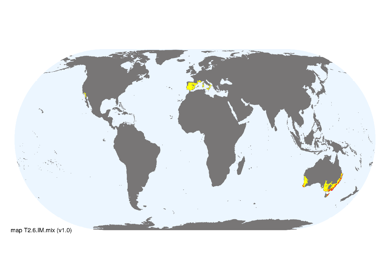
Overview of distribution
Temperate regions of Australia, the Mediterranean, and California.
Map description
Major and minor occurrences were initially identified using consensus land-cover maps (Tuanmu et al. 2014) and then cropped to selected terrestrial ecoregions (Dinerstein et al. 2017) at 30 arc seconds spatial resolution. Ecoregions were selected if: i) their descriptions mentioned features consistent with those identified in the profile of the Ecosystem Functional Group; and ii) if their location was consistent with the ecological drivers described in the profile..
Map code and version: T2.6.web.mix v1.0, available at ![]()
Version history
Profile versions
- v2.1 (2022-04-06): DA Keith; F Essl; J Franklin; R Mac Nally.1
- v2.01 (2021-12-31): NA.
- v2.0 (2020-05-31): DA Keith; F Essl; J Franklin; R Mac Nally.
- v1.0 (2020-01-20): DA Keith; F Essl; J Franklin; RC Mac Nally.
Available maps
Read more details about the current map versions here.
- Web navigation (code: T2.6.web.mix, version v1.0)

- Indicative Map (code: T2.6.IM.mix, version v1.0)
Read more details about older or alternative versions of maps for this functional group.
- Web navigation: requires review (code: T2.6.web.orig, version v1.0)
- Indicative Map: discarded (code: T2.6.IM.orig, version v1.0)
- Web navigation: in preparation (code: T2.6.WM.nwx, version v1.0)
References
Main references
References used in the different versions of the profiles.
- Barbour M, Keeler-Wolf T, Schoenherr AA (2007) Terrestrial vegetation of California 3rd edition. University of California Press, Berkeley
- Tozer MG, Simpson CC, Jansens IB, Keith DA (2017) Biogeography of Australia’s dry sclerophyll forests: drought, nutrients and fire Australian vegetation (Ed. DA Keith), pp 314-338. Cambridge University Press, Cambridge. ISBN 978-1-107-11843-0
Map references
References used in the different versions of the maps (current and discarded).
- Department of Agriculture, Water and the Environment (2020) National Vegetation Information System V6.0 © Australian Government Department of Agriculture, Water and the Environment
- Dinerstein E, Olson D, Joshi A, Vynne C, Burgess ND, Wikramanayake E, Hahn N, Palminteri S, Hedao P, Noss R, Hansen M, Locke H, Ellis EE, Jones B, Barber CV, Hayes R, Kormos C, Martin V, Crist E, Sechrest W, Price L, Baillie JEM, Weeden D, Suckling K, Davis C, Sizer N, Moore R, Thau D, Birch T, Potapov P, Turubanova S, Tyukavina A, de Souza N, Pintea L, Brito JC, Llewellyn Barnekow Lillesø JP, van Breugel P, Graudal L, Voge M, Al-Shammari KF, Saleem M (2017) An Ecoregion-Based Approach to Protecting Half the Terrestrial Realm, BioScience 67: 534–545. DOI:10.1093/biosci/bix014. Data-set available on-line
- Tuanmu, M.-N. and W. Jetz (2014) A global 1-km consensus land-cover product for biodiversity and ecosystem modeling Global Ecology and Biogeography 23(9):1031–1045 DOI:10.1111/geb.12182
Footnotes
This is the current version available at official site.↩︎