T2.2 Deciduous temperate forests
T2. Temperate-boreal forests and woodlands biome
T2
Profile summary
Full profile at https://global-ecosystems.org/explore/groups/T2.2
Brief description
At cool temperate latitudes in the Northern hemisphere, fertile soils and high precipitation support forests dominated by broadleaf deciduous trees, although evergreen needleleaf trees may account for up to one-third of the canopy. Cold snow-prone winters punctuate a limited but highly productive growing season. Fungi and bacteria play vital roles in decomposition of the seasonal leaf fall on the forest floor, with insects and browsing herbivores important in carbon and nutrient cycling. Herbivores such as deer and hares are prey to feline, canine and avian predators. Winter dormancy, hibernation and migration are key strategies enabling survival of plants and animals.
Key features
Closed canopy broadleaved forests in seasonally warm and cold humid climates, with low to moderate woody species diversity.
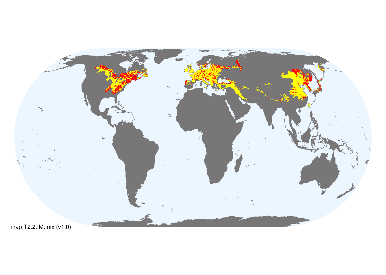
Overview of distribution
Temperate regions of the Northern Hemisphere, limited occurrences in southern South America.
Map description
Major and minor occurrences were initially identified using consensus land-cover maps (Tuanmu et al. 2014) and then cropped to selected terrestrial ecoregions (Dinerstein et al. 2017) at 30 arc seconds spatial resolution. Ecoregions were selected if: i) their descriptions mentioned features consistent with those identified in the profile of the Ecosystem Functional Group; and ii) if their location was consistent with the ecological drivers described in the profile..
Map code and version: T2.2.web.mix v1.0, available at ![]()
Version history
Profile versions
- v2.1 (2022-04-06): DA Keith; NA Brummitt; F Essl; D Faber-Langendoen.1
- v2.01 (2021-12-31): NA.
- v2.0 (2020-05-31): DA Keith; NA Brummitt; F Essl; D Faber-Langendoen.
- v1.0 (2020-01-20): DA Keith; NA Brummitt; F Essl; D Faber-Langendoen.
Available maps
Read more details about the current map versions here.
- Indicative Map (code: T2.2.IM.mix, version v1.0)
- Web navigation (code: T2.2.web.mix, version v1.0)

Read more details about older or alternative versions of maps for this functional group.
- Indicative Map: superceded (code: T2.2.IM.alt, version v2.0)
- Indicative Map: superceded (code: T2.2.IM.orig, version v1.0)
- Web navigation: requires review (code: T2.2.web.orig, version v1.0)
References
Main references
References used in the different versions of the profiles.
- Box EO, Fujiwara K (2015) Warm temperate deciduous forests Springer, Cham.
- Röhrig E, Ulrich B (1991) Temperate deciduous forests Ecosystems of the world Vol. 7. Elsevier, Amsterdam
Map references
References used in the different versions of the maps (current and discarded).
- Dinerstein E, Olson D, Joshi A, Vynne C, Burgess ND, Wikramanayake E, Hahn N, Palminteri S, Hedao P, Noss R, Hansen M, Locke H, Ellis EE, Jones B, Barber CV, Hayes R, Kormos C, Martin V, Crist E, Sechrest W, Price L, Baillie JEM, Weeden D, Suckling K, Davis C, Sizer N, Moore R, Thau D, Birch T, Potapov P, Turubanova S, Tyukavina A, de Souza N, Pintea L, Brito JC, Llewellyn Barnekow Lillesø JP, van Breugel P, Graudal L, Voge M, Al-Shammari KF, Saleem M (2017) An Ecoregion-Based Approach to Protecting Half the Terrestrial Realm, BioScience 67: 534–545. DOI:10.1093/biosci/bix014. Data-set available on-line
- Karger, D.N., Conrad, O., Böhner, J., Kawohl, T., Kreft, H., Soria-Auza, R.W., Zimmermann, N.E., Linder, H.P. & Kessler, M. (2017) Climatologies at high resolution for the earth’s land surface areas. Scientific Data 4, 170122.
- Tuanmu, M.-N. and W. Jetz (2014) A global 1-km consensus land-cover product for biodiversity and ecosystem modeling Global Ecology and Biogeography 23(9):1031–1045 DOI:10.1111/geb.12182
Footnotes
This is the current version available at official site.↩︎