SM1.3 Sea caves
SM1. Subterranean tidal biome
SM1
Profile summary
Full profile at https://global-ecosystems.org/explore/groups/SM1.3
Brief description
Sea caves are formed by waves action on fissures in a wide range of rocky coastlines around the world. Unlike anchialine caves, salinity gradients are weak and a strong marine influence is maintained throughout their extent. They support a range of sessile invertebrates (e.g. sponges, cnidarians, bryozoans), mobile invertebrates (e.g. molluscs, crustaceans, annelids,) and fish. Some organisms appear to be exclusive to sea caves, some shelter in sea caves diurnally, and others are itinerant visitors.
Key features
Wave-exposed caves provide dim light and shelter to cave-exclusive, resident and transient/ migratory invertebrates and fish..
Overview of distribution
Coastal headlands, rocky and coral reefs globally.
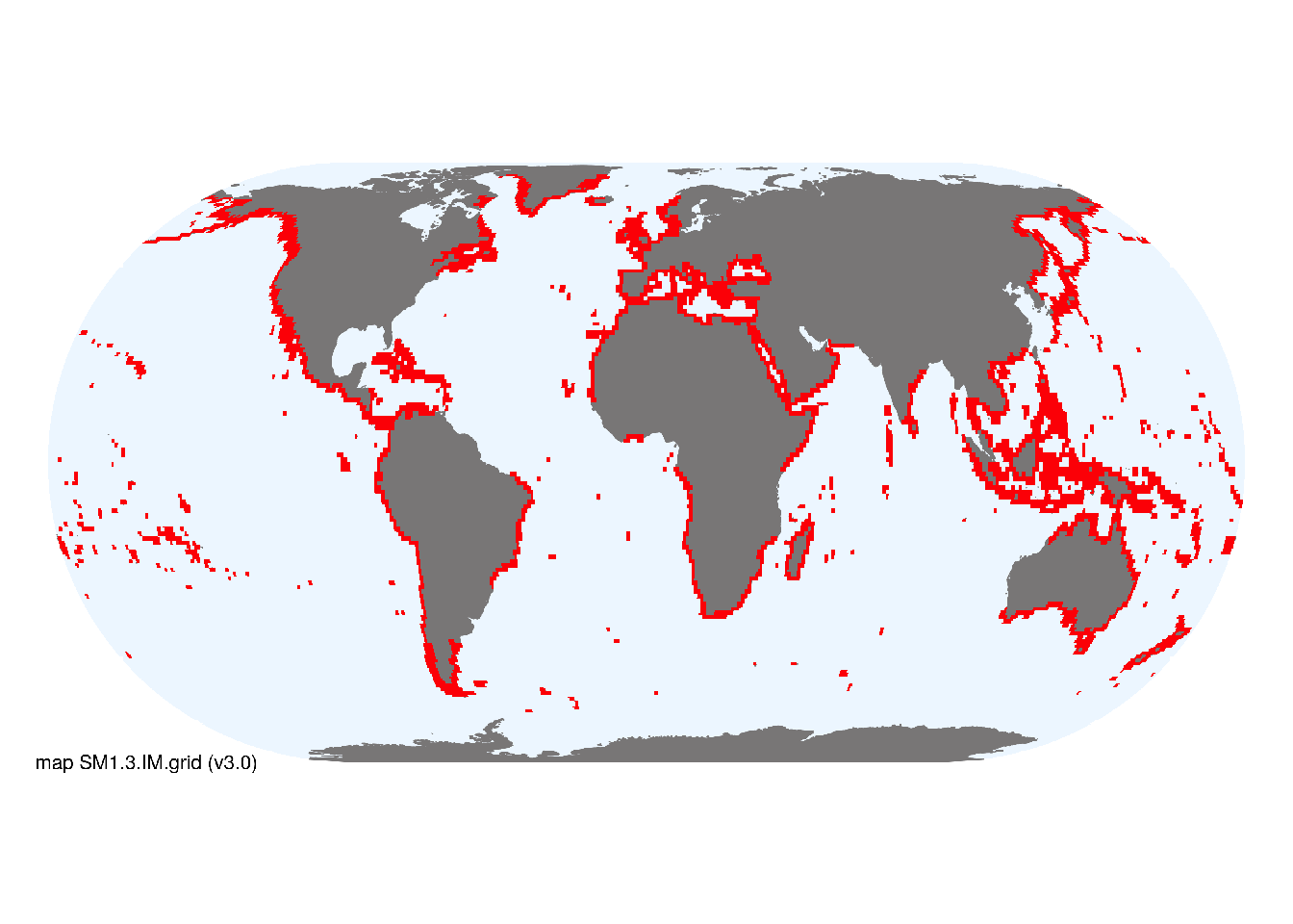
Map description
Marine ecoregions (Spalding et al. 2008) containing occurrences of rocky coastline (see MT1.1) were verified by inspection of imagery available in Google Earth to identify an envelope of potential distribution for sea caves. The coastlines within these ecoregions were summarised using a template of 1-degree grid cell intersected with the coast. As caves represent a small portion of such coastlines, all mapped areas were designated as minor occurrences..
Map code and version: SM1.3.web.grid v3.0, available at ![]()
Version history
Profile versions
- v2.1 (2022-04-06): TM Iliffe; D Brankovits; V Gerovasileiou; B Gonzalez; A Martínez García; DA Keith.1
- v2.01 (2021-12-31): NA.
- v2.0 (2020-06-17): V Gerovasileiou; TM Iliffe; V Gerovasileiou; B Gonzalez; D Brankovits; A Martínez García; DA Keith.
Available maps
Read more details about the current map versions here.
- Indicative Map (code: SM1.3.IM.grid, version v3.0)
- Web navigation (code: SM1.3.web.grid, version v3.0)

Read more details about older or alternative versions of maps for this functional group.
- Indicative Map: discarded (code: SM1.3.IM.grid, version v2.0)
- Indicative Map: discarded (code: SM1.3.IM.orig, version v1.0)
- Web navigation: requires review (code: SM1.3.web.orig, version v1.0)
References
Main references
References used in the different versions of the profiles.
- Cicogna F, Bianchi CN, Ferrari G, Forti P (2003) Le grotte marine: cinquant’anni di ricerca in Italia Ministero dell’Ambiente e della Tutela del Territorio: Roma
- Gerovasileiou V, Bianchi CN (2019) Mediterranean marine caves: a synthesis of current knowledge MedKeyHabitats II Project (UNEP-MAP, SPA/RAC: Tunis
- Gerovasileiou V, Martínez A, Álvarez F, Boxshall G, Humphreys W, Jaume D, Becking L, Muricy G, van Hengstum P, Dekeyzer S, Decock W, Vanhoorne B, Vandepitte L, Bailly N, Iliffe T (2016) World Register of marine Cave Species (WoRCS): a new thematic species database for marine and anchialine cave biodiversity Research Ideas and Outcomes 2, e10451
- Riedl R (1966) Biologie der Meereshöhlen Paul Parey: Hamburg
Map references
References used in the different versions of the maps (current and discarded).
- Spalding MD, Fox HE, Allen GR, Davidson N, Ferdaña ZA, Finlayson M, Halpern BS, Jorge MA, Lombana A, Lourie SA, Martin KD, McManus E, Molnar J, Recchia CA, Robertson J (2007) Marine ecoregions of the world: a bioregionalization of coastal and shelf areas. Bioscience 57: 573–583. DOI:10.1641/B570707
Footnotes
This is the current version available at official site.↩︎