SF1.1 Underground streams and pools
SF1. Subterranean freshwaters biome
SF1
Profile summary
Full profile at https://global-ecosystems.org/explore/groups/SF1.1
Brief description
These dark aquatic systems buried below ground have varied levels of connectivity to surface waters, which influence their traits and processes profoundly. Microbial mats composed of bacteria and aquatic fungi on submerged rock surfaces are major food sources for protozoans and invertebrates, especially in systems that are isolated from surface waters. Larger water bodies support predatory fish. When connectivity is strong, inflow brings a supply of nutrients and organic matter, as well as itinerant biota.
Key features
Water-filled subterranean voids with low diversity of light-limited bacteria, fungi, detrivores and predators..
Overview of distribution
Scattered lobally in limestone or more rarely basalt or other lithic substrates.
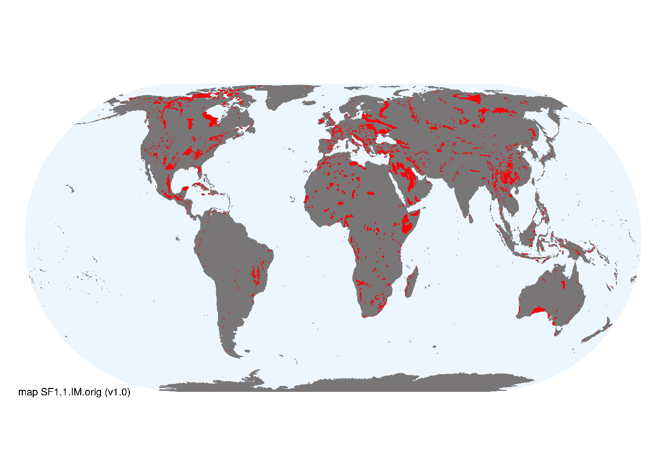
Map description
Distributions of Underground streams and pools were based on mapped area of carbonate rock outcrop (Williams & Ting Fong 2016). This. provides an upper limit on the area of exposed karst terrain, as not all carbonate rocks are karstified. Lava tubes and other rocks that may contain these ecosystem functional groups are not shown on this indicative map, but are less extensive than those in carbonate rock..
Map code and version: SF1.1.web.orig v1.0, available at ![]()
Version history
Profile versions
- v2.1 (2022-04-06): DA Keith; GC Hose.1
- v2.01 (2021-12-31): NA.
- v2.0 (2020-06-17): DA Keith; GC Hose.
- v1.0 (2020-01-20): DA Keith.
Available maps
Read more details about the current map versions here.
- Indicative Map (code: SF1.1.IM.orig, version v1.0)
- Web navigation (code: SF1.1.web.orig, version v1.0)

Read more details about older or alternative versions of maps for this functional group.
References
Main references
References used in the different versions of the profiles.
- Gibert J, Deharveng L (2002) Subterranean ecosystems: a truncated functional biodiversity BioScience 52, 473-481 DOI:10.1641/0006-3568(2002)052[0473:seatfb]2.0.co;2
Map references
References used in the different versions of the maps (current and discarded).
- Williams P, Ting Fong Y (2016) World map of carbonate rock outcrops v3.0 The University of Auckland, Auckland. Webpage
Footnotes
This is the current version available at official site.↩︎