MT1.4 Boulder and cobble shores
MT1. Shorelines biome
MT1
Profile summary
Full profile at https://global-ecosystems.org/explore/groups/MT1.4
Brief description
Cobbled and boulder shores are exposed to wave action and tides, and are periodically restructured by high-energy storm events. Drift seaweed and local algae support communities of organisms adapted to regular disturbance and grinding of rocks and cobbles, as well as the high temperatures and desiccation common to all shorelines. For example, many live largely below the surface layers. Stability of the substrate, and hence the biota, depends on the size of the cobbles and boulders. Some encrusting species or algae like cordgrass can stabilise these shores and allow a wider range of plants and animals to establish.
Key features
Unstable intertidal hard substrate, that supports encrusting and fouling species at low elevations and in some instances vegetation, though largely dependent on allocthonous production.
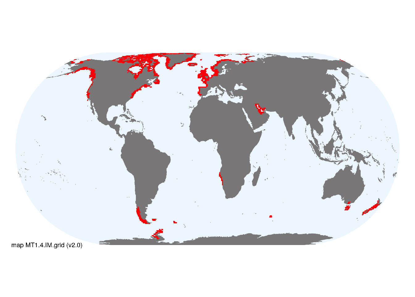
Overview of distribution
High-latitude shorelines receiving cobbles from rivers, glaciers or erosion of cliffs.
Map description
Marine ecoregions (Spalding et al. 2008) containing rocky shorelines and boulder and cobble shorelines, respectively, were identified by consulting regional substrate maps, imagery available in Google Earth (to exclude ecoregions with extensive sandy or muddy shores) and expertise of authors, proofed by specialist reviewers..
Map code and version: MT1.4.web.map v1.0, available at ![]()
Version history
Profile versions
- v2.1 (2022-04-06): MJ Bishop; SL McSweeney; AH Altieri; DA Keith.1
- v2.01 (2021-12-31): NA.
- v2.0 (2020-07-31): MJ Bishop; SL McSweeney; AH Altieri; DA Keith.
- v1.0 (2020-01-20): MJ Bishop; DA Keith.
Available maps
Read more details about the current map versions here.
- Indicative Map (code: MT1.4.IM.grid, version v2.0)
- Web navigation (code: MT1.4.web.map, version v1.0)

Read more details about older or alternative versions of maps for this functional group.
- Indicative Map: discarded (code: MT1.4.IM.orig, version v2.1)
- Web navigation: discarded (code: MT1.4.web.grid, version v2.0)
- Web navigation: requires review (code: MT1.4.web.orig, version v1.0)
- Indicative Map: discarded (code: MT1.4.IM.grid, version v1.0)
- Indicative Map: discarded (code: MT1.4.IM.orig, version v1.0)
References
Main references
References used in the different versions of the profiles.
- Altieri AH, Silliman BR, Bertness MD (2007) Hierarchical organization via a facilitation cascade in intertidal cordgrass bed communities The American Naturalist 169: 195-206 DOI:10.1086/510603
- Scott GAM (1963) The ecology of shingle beach plants Journal of Ecology 51: 517-527 DOI:10.2307/2257745
Map references
References used in the different versions of the maps (current and discarded).
- Harris PT, Macmillan-Lawler M, Rupp J, Baker EK (2014) Geomorphology of the oceans. Marine Geology 352: 4-24. 10.1016/j.margeo.2014.01.011
- Spalding MD, Fox HE, Allen GR, Davidson N, Ferdaña ZA, Finlayson M, Halpern BS, Jorge MA, Lombana A, Lourie SA, Martin KD, McManus E, Molnar J, Recchia CA, Robertson J (2007) Marine ecoregions of the world: a bioregionalization of coastal and shelf areas. Bioscience 57: 573–583. DOI:10.1641/B570707
Footnotes
This is the current version available at official site.↩︎