MT1.1 Rocky Shorelines
MT1. Shorelines biome
MT1
Profile summary
Full profile at https://global-ecosystems.org/explore/groups/MT1.1
Brief description
Waves, tides and a gradient of exposure drive the structure and function of these productive intertidal ecosystems found mostly on high energy coasts. The biota includes filter feeders like barnacles, mussels and sea squirts which compete for limited space. Grazers like limpets and urchins consume small sessile algae, while predators such as crabs, fish and birds consume a wide range of prey. Organisms use microhabitats during low tide (e.g. rockpools, crevices) or have adaptations like shells to survive exposure to high temperatures, salinity and desiccation.
Key features
Hard intertidal substrate, dominated by sessile and mobile invertebrates, and macroalgae.
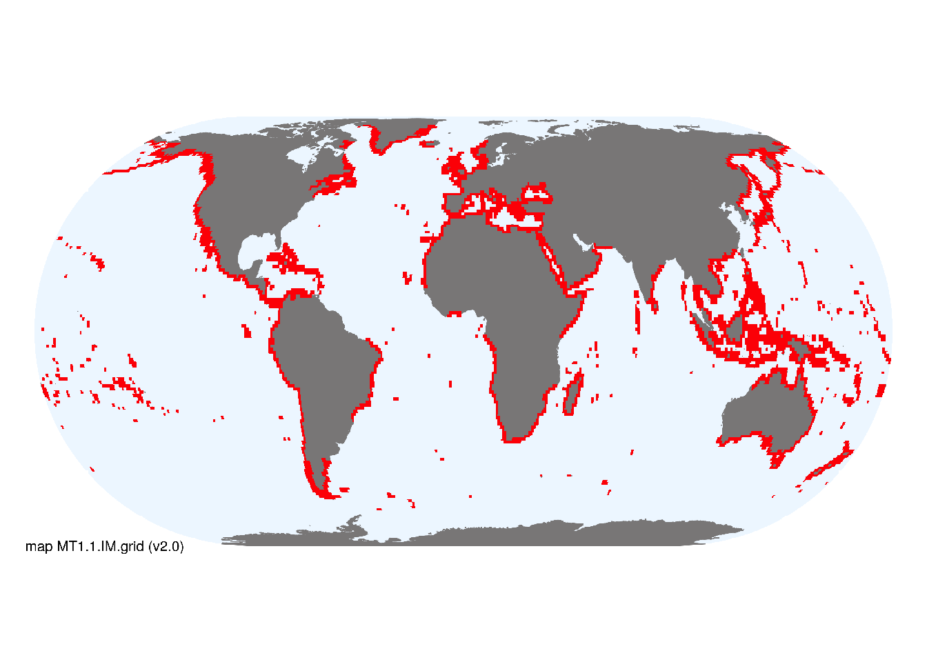
Overview of distribution
High-energy shorelines globally.
Map description
Marine ecoregions (Spalding et al. 2008) containing rocky shorelines and boulder and cobble shorelines, respectively, were identified by consulting regional substrate maps, imagery available in Google Earth (to exclude ecoregions with extensive sandy or muddy shores) and expertise of authors, proofed by specialist reviewers..
Map code and version: MT1.1.web.map v1.0, available at ![]()
Version history
Profile versions
- v2.1 (2022-04-06): MJ Bishop; LB Firth; SL McSweeney; TP Crowe; AH Altieri; DA Keith.1
- v2.01 (2021-12-31): NA.
- v2.0 (2020-05-28): MJ Bishop; LB Firth; SL McSweeney; TP Crowe; AH Altieri; DA Keith.
- v1.0 (2020-01-20): MJ Bishop; DA Keith.
Available maps
Read more details about the current map versions here.
- Indicative Map (code: MT1.1.IM.grid, version v2.0)
- Web navigation (code: MT1.1.web.map, version v1.0)

Read more details about older or alternative versions of maps for this functional group.
- Indicative Map: discarded (code: MT1.1.IM.orig, version v2.1)
- Web navigation: discarded (code: MT1.1.web.grid, version v2.0)
- Indicative Map: requires more work (code: MT1.1.IM.grid, version v1.0)
- Indicative Map: discarded (code: MT1.1.IM.orig, version v1.0)
- Web navigation: requires review (code: MT1.1.web.orig, version v1.0)
References
Main references
References used in the different versions of the profiles.
- Connell JH (1972) Community interactions on marine rocky intertidal shores Annual Review of Ecology and Systematics 3:169-192 DOI:10.1146/annurev.es.03.110172.001125
- Thompson RC, Crowe TP, Hawkins SJ (2002) Rocky intertidal communities: past environmental changes, present status and predictions for the next 25 years Environmental Conservation 29:168-91 DOI:10.1017/s0376892902000115
Map references
References used in the different versions of the maps (current and discarded).
- Harris PT, Macmillan-Lawler M, Rupp J, Baker EK (2014) Geomorphology of the oceans. Marine Geology 352: 4-24. 10.1016/j.margeo.2014.01.011
- Spalding MD, Fox HE, Allen GR, Davidson N, Ferdaña ZA, Finlayson M, Halpern BS, Jorge MA, Lombana A, Lourie SA, Martin KD, McManus E, Molnar J, Recchia CA, Robertson J (2007) Marine ecoregions of the world: a bioregionalization of coastal and shelf areas. Bioscience 57: 573–583. DOI:10.1641/B570707
Footnotes
This is the current version available at official site.↩︎