MFT1.1 Coastal river deltas
MFT1. Brackish tidal biome
MFT1
Profile summary
Full profile at https://global-ecosystems.org/explore/groups/MFT1.1
Brief description
At the convergence of terrestrial, freshwater and marine realms, coastal river deltas are shaped by river inflows that deposit sediment and ocean tides and currents that disperse it. Gradients of salinity and submergence and dynamic substrates create shifting mosaics of channels, islands, floodplains, intertidal and subtidal mud plains and sand beds that may be regarded as embedded patches of other functional groups. The dynamic mosaics support complex foodwebs. Planktonic algae, aquatic plants and river inflows contribute detritus for in-sediment fauna. Fish and zooplankton are diverse and abundant in the water column, providing food for wading and fishing birds and marine and terrestrial predators.
Key features
Depositional, mosaic systems with strong gradients between terrestrial, freshwater and marine elements. Productive with diverse plankton, fish, birds and mammals..
Overview of distribution
Continental margins of high rainfall catchments globally.
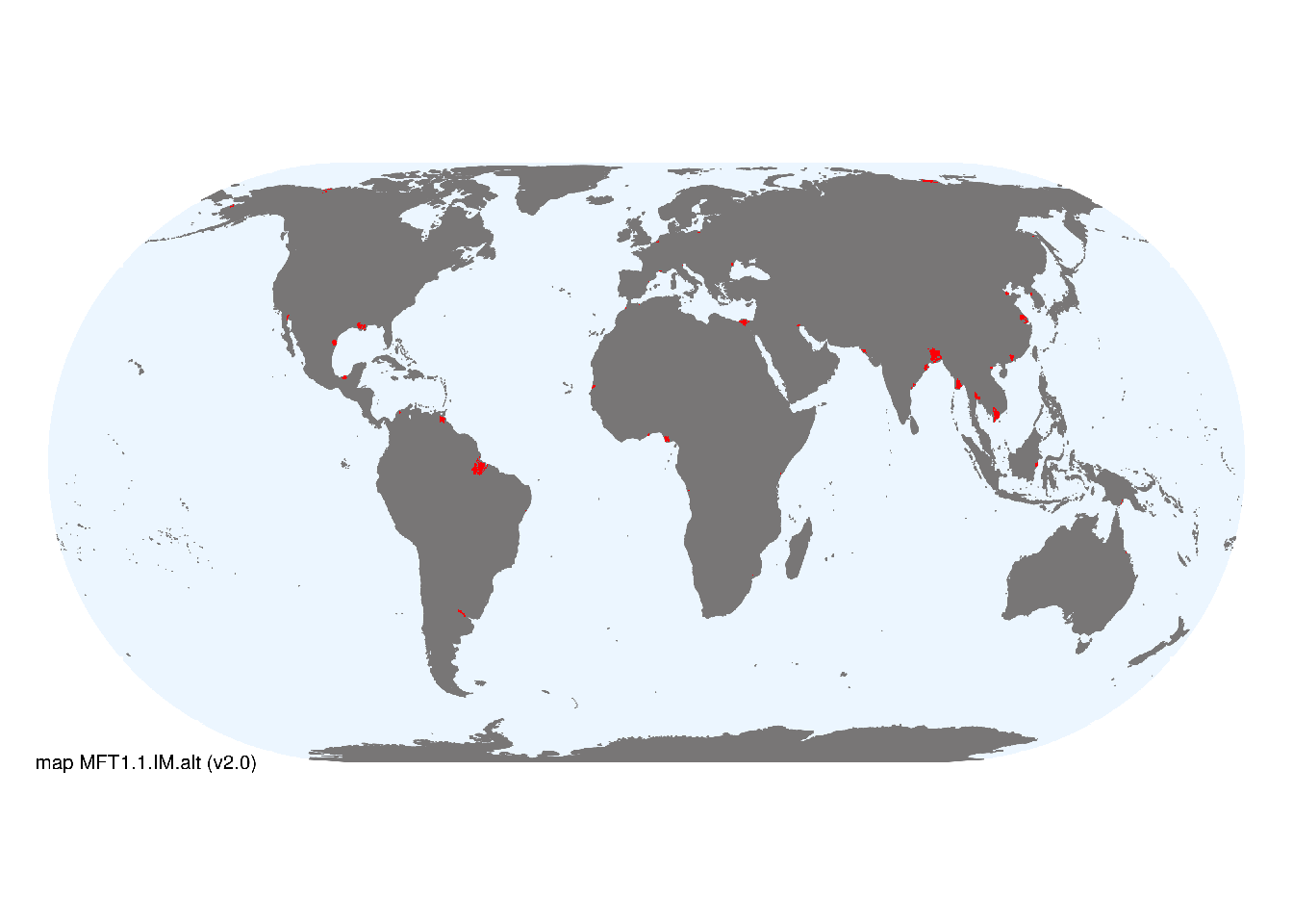
Map description
The extent of major coastal deltas was taken directly from Tessler et al. (2015), which was checked for completeness against point locations shown in Fig. 1 of Goodbred & Saito (2012) and found to be inclusive of major occurrences. Represented at a spatial resolution of 30 arc-seconds. Original map at Deltas at risk..
Map code and version: MFT1.1.map.orig v1.0, available at ![]()
Version history
Profile versions
- v2.1 (2022-04-06): DA Keith; RT Kingsford.1
- v2.01 (2021-12-31): NA.
- v2.0 (2020-05-28): DA Keith; RT Kingsford.
- v1.0 (2020-01-20): .
Available maps
Read more details about the current map versions here.
- Indicative Map (code: MFT1.1.WM.nwx, version v1.0)
Read more details about older or alternative versions of maps for this functional group.
- Web navigation: requires review (code: MFT1.1.web.orig, version v2.0)
- Indicative Map: discarded (code: MFT1.1.IM.alt, version v2.0)
- Indicative Map: discarded (code: MFT1.1.IM.orig, version v1.0)
- Web navigation: superceded (code: MFT1.1.web.orig, version v1.0)
- Web navigation: discarded (code: MFT1.1.map.orig, version v1.0)

References
Main references
References used in the different versions of the profiles.
- Bianchi TS, Allison MA (2009) Large-river delta-front estuaries as natural “recorders” of global environmental change Proceedings of the National Academy of Sciences of the USA 106:8085-8092 DOI:10.1073/pnas.0812878106
- Orton GJ, Reading G (1993) Variability of deltaic processes in terms of sediment supply, with particular emphasis on grain-size Sedimentology 40:475-512 DOI:10.1111/j.1365-3091.1993.tb01347.x
Map references
References used in the different versions of the maps (current and discarded).
- Goodbred SL, Saito Y (2012) Tide-dominated deltas. In: Principles of tidal sedimentology (Eds. RA Davis, RW Dalrymple), pp 129-149. Springer, Berin. DOI: 10.1007/978-94-007-0123-6_7
- Nienhuis, J.H., Ashton, A.D., Edmonds, D.A. et al. (2020) Global-scale human impact on delta morphology has led to net land area gain Nature 577, 514–518 DOI:10.1038/s41586-019-1905-9
- Z.D. Tessler, C.J. Vörösmarty, M. Grossberg, I. Gladkova, H. Aizenman, J.P.M. Syvitski, E. Foufoula-Georgiou (2015) Profiling Risk and Sustainability in Coastal Deltas of the World Science 349(6248), 638-643 DOI:10.1126/science.aab3574
Footnotes
This is the current version available at official site.↩︎