M2.4 Abyssopelagic ocean waters
M2. Pelagic ocean waters biome
M2
Profile summary
Full profile at https://global-ecosystems.org/explore/groups/M2.4
Brief description
At greater depths (~3,000-6,000m) than bathypelagic systems, these very deep open ocean ecosystems receive no light and rely solely on debris from upper layers for nutrients. Other resources such as oxygen are replenished via the ‘global ocean conveyer belt’ (thermohaline circulation) that starts when distant, polar surface waters cool and sink. There is a low diversity and low density of life, largely planktonic detritivores, along with some gelatinous invertebrates and scavenging or predatory fish like the anglerfish. Life histories body structures and physiological traits are adapted to the very high pressure and lack of light (e.g. non-visual sensory organs, specialised metabolic proteins, and low density body structures).
Key features
Lightless, high pressure depths with limited nutrients and low biodiversity of adapted detrivores, jellies, scavengers and predatory fish.
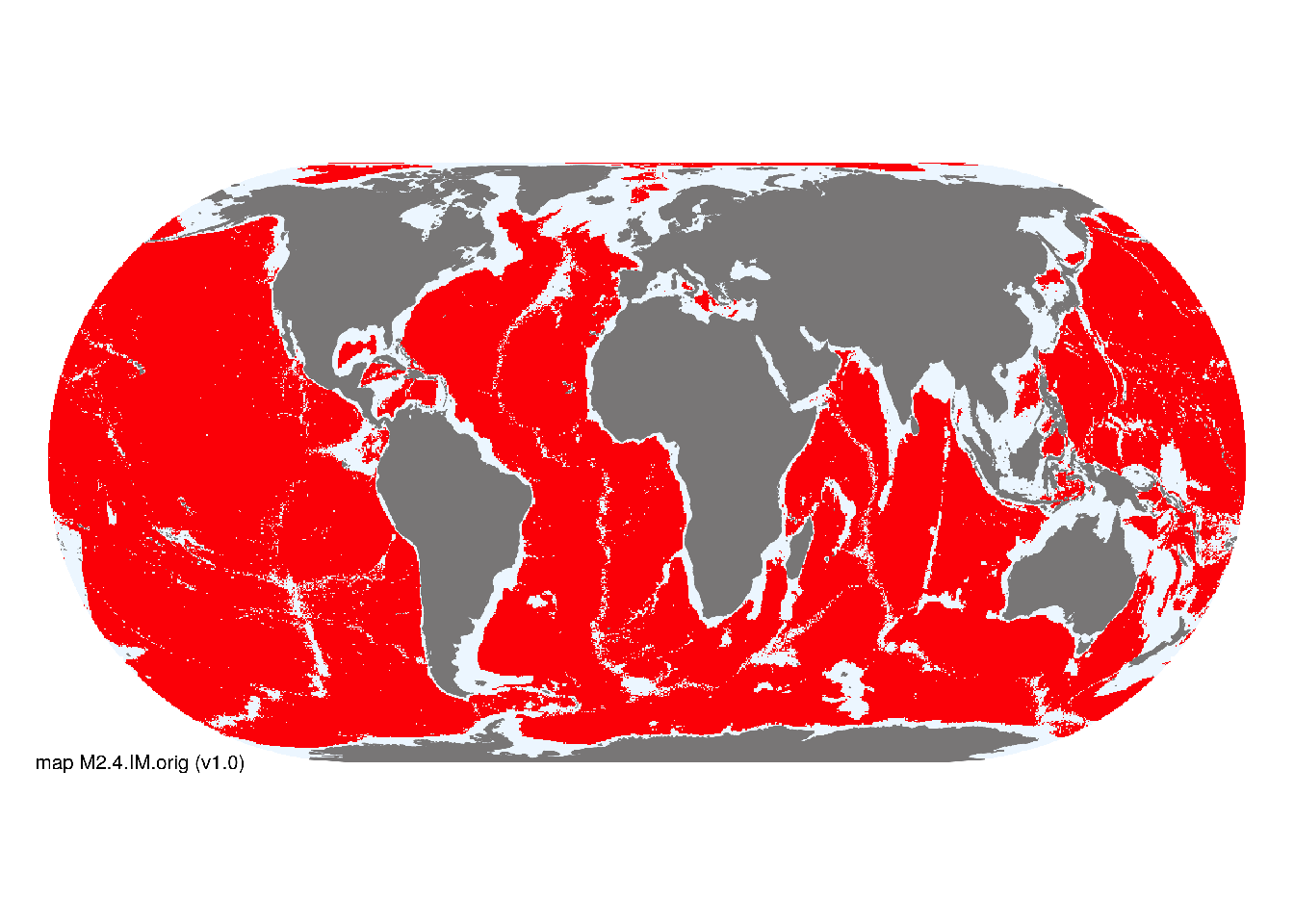
Overview of distribution
Deep oceans between 3000 - 6000m.
Map description
Indicative distributions of these marine pelagic ecosystem functional groups were derived from bathymetric spatial data obtained from Becker et al. (2009) using depth range thresholds cited in respective descriptive profiles for each functional group. Occurrences were mapped at 30 arc second spatial resolution..
Map code and version: M2.4.web.orig v1.0, available at ![]()
Version history
Profile versions
- v2.1 (2022-04-06): C Linardich; DA Keith.1
- v2.01 (2021-12-31): NA.
- v2.0 (2020-05-27): C Linardich; DA Keith.
- v1.0 (2020-01-20): C Linardich; DA Keith.
Available maps
Read more details about the current map versions here.
- Indicative Map (code: M2.4.IM.orig, version v1.0)
- Web navigation (code: M2.4.web.orig, version v1.0)

Read more details about older or alternative versions of maps for this functional group.
- Web navigation: in preparation (code: M2.4.WM.nwx, version v1.0)
References
Main references
References used in the different versions of the profiles.
- Priede, IG (2017) Deep-sea fishes: Biology, diversity, ecology and fisheries Chapter 1. Cambridge University Press, Cambridge DOI:10.1017/9781316018330
Map references
References used in the different versions of the maps (current and discarded).
- Becker JJ, Sandwell DT, Smith WHF, Braud J, Binder B, Depner J, Fabre D, Factor J, Ingalls S, Kim S-H, Ladner R, Marks K, Nelson S, Pharaoh A, Trimmer R, Von Rosenberg J, Wallace G, Weatherall P (2009) Global Bathymetry and Elevation Data at 30 Arc Seconds Resolution: SRTM30_PLUS, Marine Geodesy 32: 355-371. DOI:10.1080/01490410903297766
- Sayre, R.G., D.J. Wright, S.P. Breyer, K.A. Butler, K. Van Graafeiland, M.J. Costello, P.T. Harris, K.L. Goodin, J.M. Guinotte, Z. Basher, M.T. Kavanaugh, P.N. Halpin, M.E. Monaco, N. Cressie, P. Aniello, C.E. Frye, and D. Stephens (2017) A three-dimensional mapping of the ocean based on environmental data Oceanography 30(1):90–103 DOI:10.5670/oceanog.2017.116
Footnotes
This is the current version available at official site.↩︎