M2.3 Bathypelagic ocean waters
M2. Pelagic ocean waters biome
M2
Profile summary
Full profile at https://global-ecosystems.org/explore/groups/M2.3
Brief description
These deep (~1000-3000m depth), open-ocean ecosystems receive no sunlight and rely on detritus from upper layers for nutrients. Other resources such as oxygen are replenished via the ‘global ocean conveyer belt’ (thermohaline circulation) that starts when distant, polar surface waters cool and sink. With no primary producers, life is limited to groups like zooplankton, jellyfish, crustaceans, cephalopods and fish like the gulper eel. Common adaptations that enable animals to live under high pressure and no light include slow metabolism, long generation lengths and low density bodies.
Key features
Lightless, high pressure depths where adapted zooplankton, crustaceans, jellies, cephalopods and fish rely on nutrients falling from above.
Overview of distribution
Deep oceans between 1000 - 3000m.
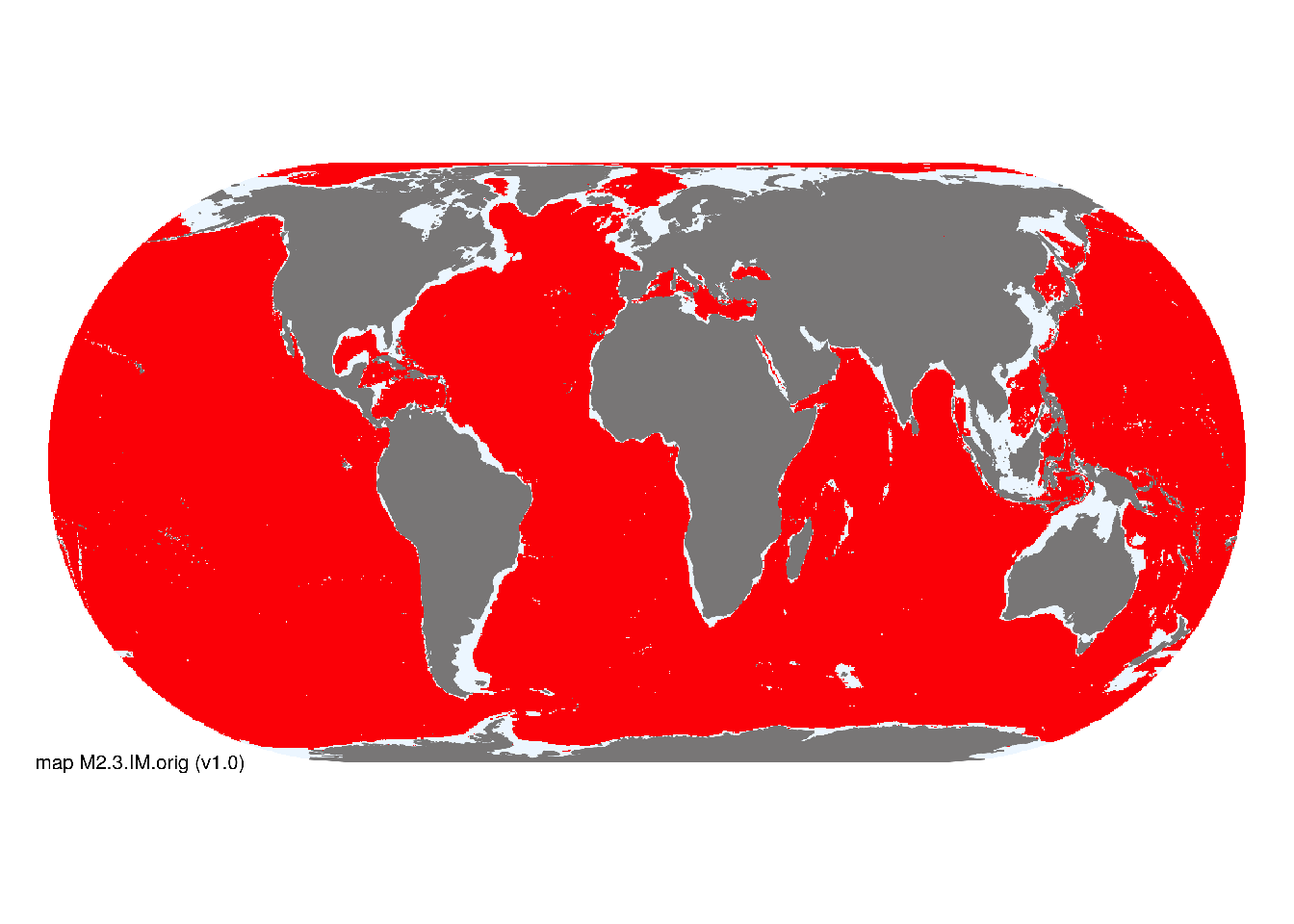
Map description
Indicative distributions of these marine pelagic ecosystem functional groups were derived from bathymetric spatial data obtained from Becker et al. (2009) using depth range thresholds cited in respective descriptive profiles for each functional group. Occurrences were mapped at 30 arc second spatial resolution..
Map code and version: M2.3.web.orig v1.0, available at ![]()
Version history
Profile versions
- v2.1 (2022-04-06): C Linardich; TT Sutton; IG Priede; DA Keith.1
- v2.01 (2021-12-31): NA.
- v2.0 (2020-05-27): C Linardich; TT Sutton; IG Priede; DA Keith.
- v1.0 (2020-01-20): C Linardich; DA Keith.
Available maps
Read more details about the current map versions here.
- Web navigation (code: M2.3.web.orig, version v1.0)

- Indicative Map (code: M2.3.IM.orig, version v1.0)
Read more details about older or alternative versions of maps for this functional group.
- Web navigation: in preparation (code: M2.3.WM.nwx, version v1.0)
References
Main references
References used in the different versions of the profiles.
- Priede, IG (2017) Deep-sea fishes: Biology, diversity, ecology and fisheries Chapter 1. Cambridge University Press, Cambridge DOI:10.1017/9781316018330
Map references
References used in the different versions of the maps (current and discarded).
- Becker JJ, Sandwell DT, Smith WHF, Braud J, Binder B, Depner J, Fabre D, Factor J, Ingalls S, Kim S-H, Ladner R, Marks K, Nelson S, Pharaoh A, Trimmer R, Von Rosenberg J, Wallace G, Weatherall P (2009) Global Bathymetry and Elevation Data at 30 Arc Seconds Resolution: SRTM30_PLUS, Marine Geodesy 32: 355-371. DOI:10.1080/01490410903297766
- Sayre, R.G., D.J. Wright, S.P. Breyer, K.A. Butler, K. Van Graafeiland, M.J. Costello, P.T. Harris, K.L. Goodin, J.M. Guinotte, Z. Basher, M.T. Kavanaugh, P.N. Halpin, M.E. Monaco, N. Cressie, P. Aniello, C.E. Frye, and D. Stephens (2017) A three-dimensional mapping of the ocean based on environmental data Oceanography 30(1):90–103 DOI:10.5670/oceanog.2017.116
Footnotes
This is the current version available at official site.↩︎