F3.1 Large reservoirs
F3. Artificial wetlands biome
F3
Profile summary
Full profile at https://global-ecosystems.org/explore/groups/F3.1
Brief description
Large dams or reservoirs occur in humid, populated areas of the world. Their biological productivity and diversity is generally limited due to their depth and frequent and large changes in water level. Shallow zones have the highest diversity, with simple food webs of algae, waterbugs, birds, frogs and aquatic plants, often supporting introduced fish species. Plankton live at the surface, but life is scarce in the depths. Algal blooms may be common if there are high nutrient inputs from rivers.
Key features
Large, usually deep stratifed waterbodies impounded by walls across outflow channels. Productivity and biotic diversity are lower than unregulated lakes of simila rsize and complexity. Trophic networks are simple.
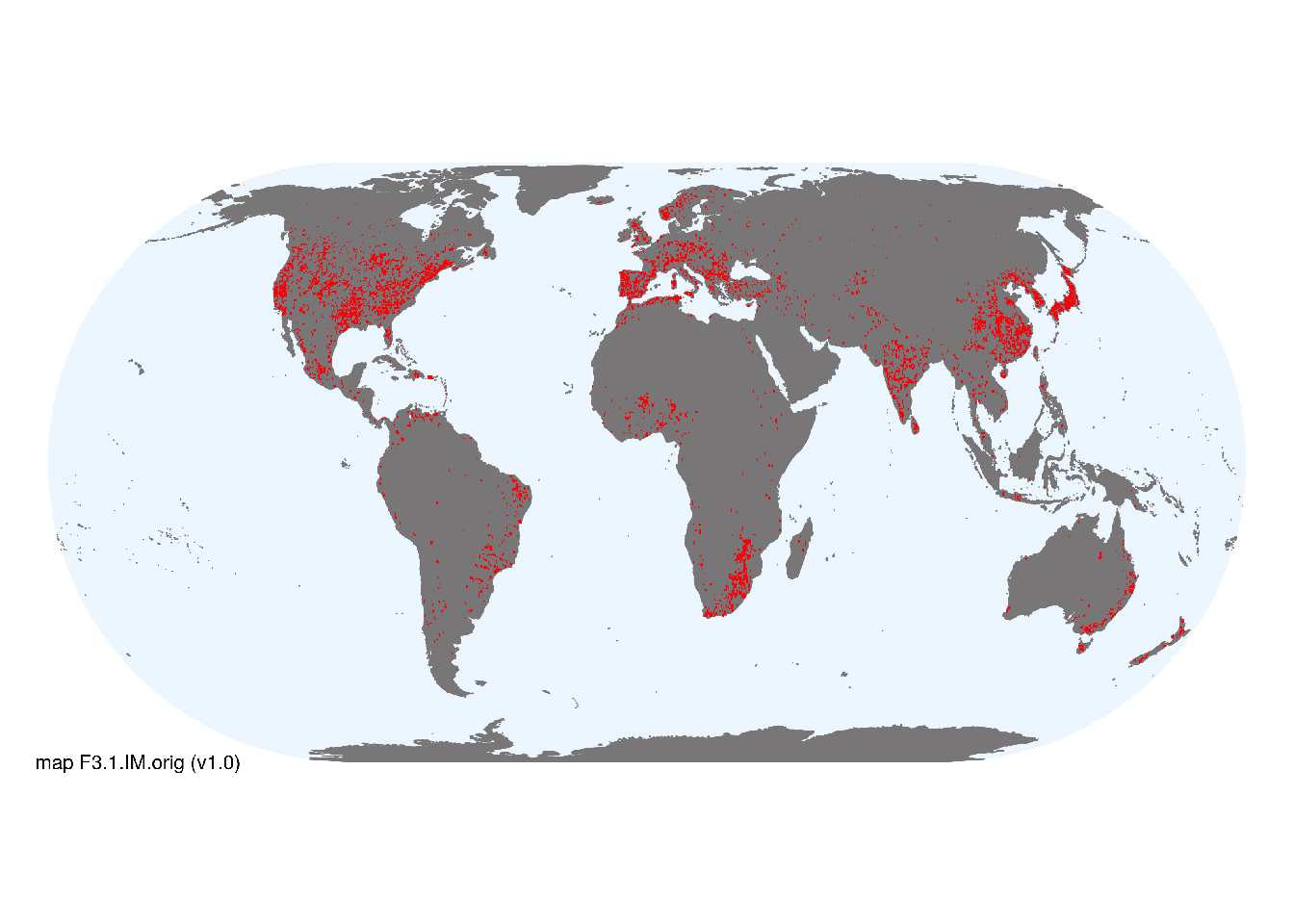
Overview of distribution
Scattered across all continents with high concentrations in Asia, Europe and North America.
Map description
Point locations of large reservoirs were obtained from water bodies tagged as ‘reservoirs’ in “reservoirs” in vector layers GLWD1 and GLWD2 of Lehner & Döll (2004). These were mapped with a spatial buffer of 15 minutes, enabling reservoirs to be represented in 0.5 degree grid cells..
Map code and version: F3.1.web.orig v1.0, available at ![]()
Version history
Profile versions
- v2.1 (2022-04-06): DJ Roux; RT Kingsford; CA Reidy Liermann; B Robson; M Kelly-Quinn; DA Keith.1
- v2.01 (2021-12-31): NA.
- v2.0 (2020-06-18): DJ Roux; RT Kingsford; CA Reidy Liermann; B Robson; M Kelly-Quinn; DA Keith.
- v1.0 (2020-01-20): DJ Roux; RT Kingsford; DA Keith.
Available maps
Read more details about the current map versions here.
- Web navigation (code: F3.1.web.orig, version v1.0)

- Indicative Map (code: F3.1.WM.nwx, version v1.0)
Read more details about older or alternative versions of maps for this functional group.
- Indicative Map: requires review (code: F3.1.IM.orig, version v1.0)
References
Main references
References used in the different versions of the profiles.
- Clavero M, Hermoso, V (2011) Reservoirs promote the taxonomic homogenization of fish communities within river basins Biodiversity and Conservation 20, 41-57 DOI:10.1007/s10531-010-9945-3
- Lehner B, Liermann CR, Revenga C, Vörösmarty C, Fekete B, Crouzet P, Döll P, Endejan M, Frenken K, Magome J, Nilsson C (2011) High‐resolution mapping of the world’s reservoirs and dams for sustainable river‐flow management Frontiers in Ecology and the Environment 9: 494-502 DOI:10.1890/100125
Map references
References used in the different versions of the maps (current and discarded).
- Lehner B, Döll P (2004) Development and validation of a global database of lakes,reservoirs and wetlands Journal of Hydrology 296: 1–22
- Messager, M.L., Lehner, B., Grill, G., Nedeva, I., Schmitt, O. (2016) Estimating the volume and age of water stored in global lakes using a geo-statistical approach Nature Communications 13603 DOI:10.1038/ncomms13603
- Mulligan, M., van Soesbergen, A. and Saenz, L. (2020) GOODD, a global dataset of more than 38,000 georeferenced dams Scientific Data 7 (31) DOI:10.1038/s41597-020-0362-5
Footnotes
This is the current version available at official site.↩︎