F2.2 Small permanent freshwater lakes
F2. Lakes biome
F2
Profile summary
Full profile at https://global-ecosystems.org/explore/groups/F2.2
Brief description
With a surface area of up to 100 km2, the diversity of small permanent lakes, ponds and pools depends on their size, depth and connectivity. Littoral vegetation and benthic energy pathways are critical to productivity and food web complexity. Deep lakes have plankton, supporting fish, birds and frogs, in different habitats of the lake. Shallow lakes are often more productive, providing breeding habitat for birds, frogs and reptiles, but limited buffering against nutrient inputs may result in regime shifts between alternative stable states dominated either by large aquatic plants or phytoplankton.
Key features
Small permanent freshwater lakes or ponds with niche diversity strongly related to size and depth, and resource subsidies from catchments. Littoral zones and benthic macrophytes are important contributors to productivity.
Overview of distribution
Predominantly in humid temperate and tropical regions.
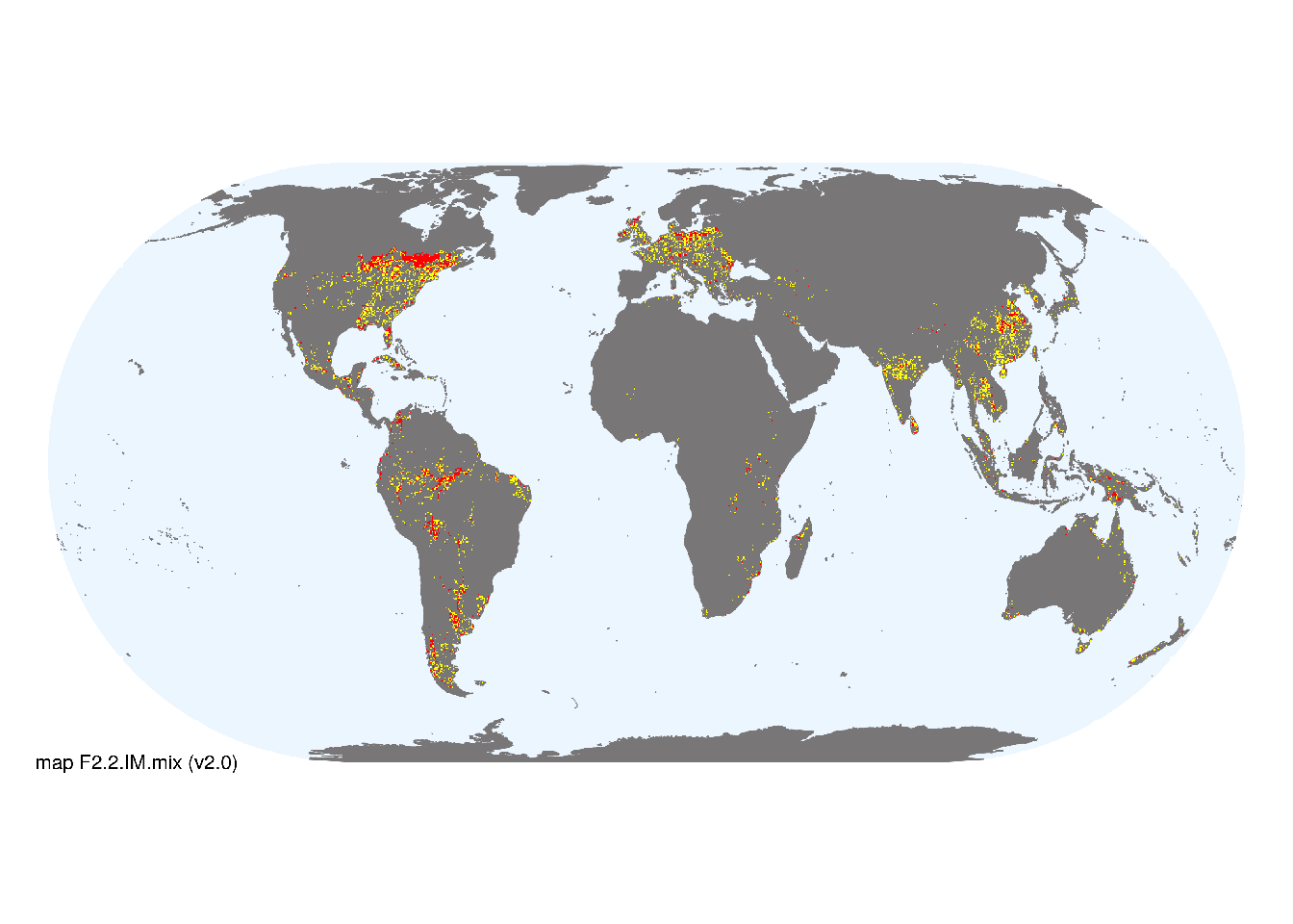
Map description
Freshwater ecoregions (Abell et al. 2008) were identified as containing occurrences of these functional groups if: i) their descriptions mentioned features consistent with those identified in the profile of the Ecosystem Functional Group; and ii) if their location was consistent with the ecological drivers described in the profile. Within those areas, locations of small lakes (<100km2), excluding artificial lakes (inclusion on types 1 and 3 only), were taken from the HydroLAKES database (Messager et al. 2016) and combined with global estimates of surface water phenology (classes 1, 2 and 7 from Pekel et al. 2016), occurrences were aggregated to 10 minutes spatial resolution..
Map code and version: F2.2.web.mix v2.0, available at ![]()
Version history
Profile versions
- v2.1 (2022-04-06): RT Kingsford; B Robson; R MacNally; L Jackson; F Essl; M Kelly-Quinn; K Irvine; S Bertilsson; DA Keith.1
- v2.01 (2021-12-31): NA.
- v2.0 (2020-06-01): RT Kingsford; B Robson; R MacNally; L Jackson; F Essl; M Kelly-Quinn; K Irvine; S Bertilsson; DA Keith.
- v1.0 (2020-01-20): RT Kingsford; RC Mac Nally; LJ Jackson; F Essl; DA Keith.
- v1.0 (2020-05-20): RT Kingsford; RC Mac Nally; LJ Jackson; F Essl; DA Keith.
Available maps
Read more details about the current map versions here.
- Indicative Map (code: F2.2.IM.mix, version v2.0)
- Web navigation (code: F2.2.web.mix, version v2.0)

Read more details about older or alternative versions of maps for this functional group.
- Indicative Map: discarded (code: F2.2.IM.alt, version v2.0)
- Indicative Map: discarded (code: F2.2.IM.mix, version v1.0)
- Web navigation: requires review (code: F2.2.web.orig, version v1.0)
- Indicative Map: discarded (code: F2.2.IM.orig, version v1.0)
- Web navigation: duplicated (code: F2.2.web.map, version v1.0)
References
Main references
References used in the different versions of the profiles.
- Jeppesen E, Jensen JP, Søndergaard M, Lauridsen T, Pedersen LJ, Jensen L (1997) Top-down control in freshwater lakes: the role of nutrient state, submerged macrophytes and water depth Shallow Lakes ’95 pp.151–164. Developments in Hydrobiology, vol 119. Springer, Dordrecht DOI:10.1007/978-94-011-5648-6_17
- Schindler DE, Scheuerell MD (2002) Habitat coupling in lake ecosystems Oikos 98:177-189
Map references
References used in the different versions of the maps (current and discarded).
- Abell R, Thieme ML, Revenga C, Bryer M, Kottelat M, Bogutskaya N, Coad B, Mandrak N, Contreras Balderas S, Bussing W, Stiassny MLJ, Skelton P, Allen GR, Unmack P, Naseka A, Ng R, Sindorf N, Robertson J, Armijo E, Higgins JV, Heibel TJ, Wikramanayake E, Olson D, López HL, Reis RE, Lundberg JG, Sabaj Pérez MH, Petry P (2008) Freshwater ecoregions of the world: A new map of biogeographic units for freshwater biodiversity conservation, BioScience 58: 403–414. DOI:10.1641/B580507
- Beck, H., Zimmermann, N., McVicar, T. et al. (2018) Present and future Köppen-Geiger climate classification maps at 1-km resolution Sci Data 5, 180214 DOI:10.1038/sdata.2018.214
- Messager, M.L., Lehner, B., Grill, G., Nedeva, I., Schmitt, O. (2016) Estimating the volume and age of water stored in global lakes using a geo-statistical approach Nature Communications 13603 DOI:10.1038/ncomms13603
- Pekel JF, Cottam A, Gorelick N, Belward AS (2016) High-resolution mapping of global surface water and its long-term changes Nature 540, 418-422 DOI:10.1038/nature20584
Footnotes
This is the current version available at official site.↩︎