F1.7 Large lowland rivers
F1. Rivers and streams biome
F1
Profile summary
Full profile at https://global-ecosystems.org/explore/groups/F1.7
Brief description
These very large rivers transport massive volumes of freshwater (>10,000m3/s) through flat lowlands, mostly in tropical or subtropical regions. Their very large flow volumes, diverse habitats and slow to moderate flows make them highly productive. High nutrient levels come from upstream catchments and floodplains, with additional productivity contributed by in-channel algae and aquatic plants. Their food webs are complex, with a high diversity of plants and animals, including large-bodied fish, reptiles and mammals.
Key features
Large highly productive rivers with megaflow rates and complex food webs, reflecting the extent of habitat, connections with floodplains and available niches for plants, invertebrates and large vertebrates including aquatic mammals..
Overview of distribution
Tropical and subtropical lowlands, with some in temperate regions with large catchments topped by wet mountain ranges.
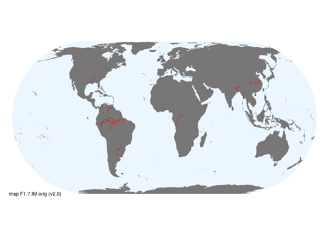
Map description
The distribution of large lowland rivers was taken from the Global River Classification database (Ouellet Dallaire et al. 2018). Reaches with flow > 10,000 m3/s were mapped with a 20 km buffer as major occurrences, clipped to exclude those with seasonal freezing temperatures (mean temperature of coldest quarter <0°C)..
Map code and version: F1.7.web.orig v2.0, available at ![]()
Version history
Profile versions
- v2.1 (2022-04-06): RT Kingsford; PS Giller; R Mac Nally; DA Keith.1
- v2.01 (2021-12-31): NA.
- v2.0 (2020-06-24): RT Kingsford; PS Giller; R Mac Nally; DA Keith.
- v1.0 (2020-02-28): RT Kingsford; R Mac Nally; DA Keith.
Available maps
Read more details about the current map versions here.
- Indicative Map (code: F1.7.IM.orig, version v2.0)
- Web navigation (code: F1.7.web.orig, version v2.0)

Read more details about older or alternative versions of maps for this functional group.
- Indicative Map: discarded (code: F1.7.IM.alt, version v1.0)
- Web navigation: requires review (code: F1.7.web.orig, version v1.0)
- Web navigation: in preparation (code: F1.7.WM.nwx, version v1.0)
References
Main references
References used in the different versions of the profiles.
- Ashworth, PJ, Lewin, J (2012) How do big rivers come to be different? Earth-Science Reviews 114, 84-107 DOI:10.1016/j.earscirev.2012.05.003
- Best, J (2019) Anthropogenic stresses on the world’s big rivers Nature Geoscience 12,7-2 DOI:10.1038/s41561-018-0262-x
Map references
References used in the different versions of the maps (current and discarded).
- Lehner, B., Grill G. (2013) Global river hydrography and network routing: baseline data and new approaches to study the world’s large river systems Hydrological Processes 27(15): 2171–2186. Data is available at www.hydrosheds.org. DOI:10.1002/hyp.9740
- Ouellet Dallaire, C., Lehner, B., Sayre, R., Thieme, M. (2018): A multidisciplinary framework to derive global river reach classifications at high spatial resolution. Environmental Research Letters 14: 024003. DOI: 10.1088/1748-9326/aad8e9
Footnotes
This is the current version available at official site.↩︎