F1.4 Seasonal upland streams
F1. Rivers and streams biome
F1
Profile summary
Full profile at https://global-ecosystems.org/explore/groups/F1.4
Brief description
Seasonal rainfall patterns in large parts of the tropics and temperate regions generate flows that are hugely variable in narrow and steep upland streams. Globally, these streams account for the greatest stream length of any flowing ecosystem. During the dry season, flows in some streams are reduced to very levels, while in others flow ceases altogether and water persists only in isolated stagnant pools. Algae and leaf fall support moderate productivity, with seasonal floods sending organic matter downstream. The diversity of organisms fluctuates seasonally, with many localised (endemic) species, and specialised adaptations that enable animals to survive both flooding and dry conditions.
Key features
High-medium velocity, low-medium volume, highly seasonal flows with abundant benthic filter feeders, algal biofilms & small fish.
Overview of distribution
Extensive in wet-dry tropics and temperate zones.
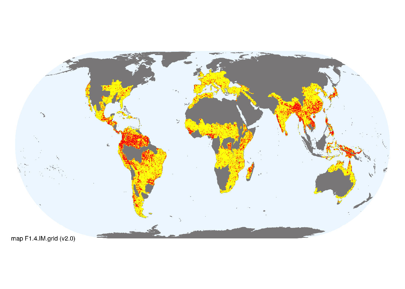
Map description
Freshwater ecoregions (Abell et al. 2008) were identified as containing occurrences of these functional groups if: i) their descriptions mentioned features consistent with those identified in the profile of the Ecosystem Functional Group; and ii) if their location was consistent with the ecological drivers described in the profile. Within the selected ecoregions, major occurrences were mapped using 1st-4th order streams (3km buffer) taken from the RiverATLAS (v1.0) database (Linke et al. 2019). The remaining areas of selected ecoregions were mapped as minor occurrences..
Map code and version: F1.4.web.map v1.0, available at ![]()
Version history
Profile versions
- v2.1 (2022-04-06): RT Kingsford; B Robson; PS Giller; AH Arthington; M Kelly-Quinn; DA Keith.1
- v2.01 (2021-12-31): NA.
- v2.0 (2020-06-24): RT Kingsford; B Robson; PS Giller; AH Arthington; M Kelly-Quinn; DA Keith.
- v1.0 (2020-05-30): RT Kingsford; DA Keith.
Available maps
Read more details about the current map versions here.
- Indicative Map (code: F1.4.IM.grid, version v2.0)
- Web navigation (code: F1.4.web.map, version v1.0)

Read more details about older or alternative versions of maps for this functional group.
- Indicative Map: discarded (code: F1.4.IM.alt, version v2.0)
- Web navigation: discarded (code: F1.4.web.grid, version v2.0)
- Indicative Map: discarded (code: F1.4.IM.orig, version v2.0)
- Web navigation: requires review (code: F1.4.web.orig, version v1.0)
- Indicative Map: replaced (code: F1.4.IM.orig, version v1.0)
- Web navigation: in preparation (code: F1.4.WM.nwx, version v1.0)
- Indicative Map: discarded (code: F1.4.IM.grid, version v1.0)
- Indicative Map: discarded (code: F1.4.IM.mix, version v1.0)
References
Main references
References used in the different versions of the profiles.
- Datry T, Bonada N, Boulton A (2017) Intermittent rivers and ephemeral streams: ecology and management (Academic Press: Burlington)
- Davies PM, Bunn SE, Hamilton SK (2008) Primary production in tropical streams and rivers Tropical stream ecology (Ed. D Dudgeon), pp. 23–42. Academic Press, London DOI:10.1016/b978-012088449-0.50004-2
- de Carvalho RA., Tejerina-Garro FL. (2018) Headwater-river gradient: trait-based approaches show functional dissimilarities among tropical fish assemblages Marine and Freshwater Research 69: 574-584 DOI:10.1071/mf17149
- Jardine RD, Bond NR, Burford MA, Kennard MJ, Ward DP, Bayliss P, Davies PM, Douglas MM, Hamilton SK, Melack JM, Naiman RJ, Pett NE, Pusey BJ, Warfe DM, Bunn SE (2015) Does flood rhythm drive ecosystem responses in tropical riverscapes? Ecology 96, 684–692 DOI:10.1890/14-0991.1
Map references
References used in the different versions of the maps (current and discarded).
- Abell R, Thieme ML, Revenga C, Bryer M, Kottelat M, Bogutskaya N, Coad B, Mandrak N, Contreras Balderas S, Bussing W, Stiassny MLJ, Skelton P, Allen GR, Unmack P, Naseka A, Ng R, Sindorf N, Robertson J, Armijo E, Higgins JV, Heibel TJ, Wikramanayake E, Olson D, López HL, Reis RE, Lundberg JG, Sabaj Pérez MH, Petry P (2008) Freshwater ecoregions of the world: A new map of biogeographic units for freshwater biodiversity conservation, BioScience 58: 403–414. DOI:10.1641/B580507
- Linke, S., Lehner, B., Ouellet Dallaire, C., Ariwi, J., Grill, G., Anand, M., Beames, P., Burchard-Levine, V., Maxwell, S., Moidu, H., Tan, F., Thieme, M. (2019) Global hydro-environmental sub-basin and river reach characteristics at high spatial resolution Scientific Data 6: 283 DOI:10.1038/s41597-019-0300-6
- Messager, M. L., Lehner, B., Cockburn, C., Lamouroux, N., Pella, H., Snelder, T., Tockner, K., Trautmann, T., Watt, C. & Datry, T. (2021) Global prevalence of non-perennial rivers and streams Nature DOI:10.1038/s41586-021-03565-5
- Ouellet Dallaire, C., Lehner, B., Sayre, R., Thieme, M. (2018): A multidisciplinary framework to derive global river reach classifications at high spatial resolution. Environmental Research Letters 14: 024003. DOI: 10.1088/1748-9326/aad8e9
Footnotes
This is the current version available at official site.↩︎